It took me years of getting around Chicago on foot, bike, bus, and train to get completely comfortable with our city's geography. But I whipped up this navigation guide with the goal of providing a handy shortcut for newcomers to our city, and I'm guessing it will be of interest to seasoned Chicagoans as well. Be warned that it starts out as a fairly cut-and-dried set of rules and instructions, but morphs into a freewheeling discussion of street name history by the end. But hopefully you'll enjoy the ride, so let's get rolling.
Madison Street is Chicago's north-south bifurcating street: Addresses on north-south streets are “North” north of Madison, and “South” south of it. But don’t make the mistake of thinking that the entire city south of Madison is the South Side, or vice versa, since our city also has a West Side (and even an East Side, although many Chicagoans aren't familiar with it.) There are also differences of opinion on where downtown Chicago ends and the South, West, and North sides begin.
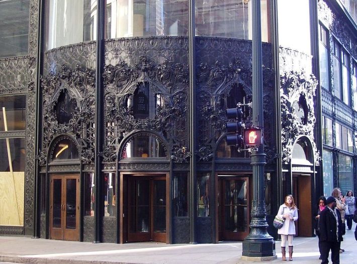
But I digress (which I'll be doing a lot of in this article.) State Street is the city's east-west bifurcating street: Addresses on east-west streets are “West” west of State and “East” east of it. Therefore the intersection Madison and State, by the lovely, Louis Sullivan-designed Carson, Pirie, Scott and Company Building, is the city’s Ground Zero.
In general, east-west streets north of Madison have names, but east-west streets south of Madison have numbers. These numbers increase as you head south from downtown (starting with 8th Street, which is eight full blocks south of Madison.)
However, some major east-west streets on the South Side have names, such as Roosevelt Road, which would otherwise be called 12th Street, since it’s 12 full blocks south of Madison. Other examples include Cermak Road (22nd Street), Pershing Road (39th Street), Garfield Boulevard (55th Street), and Marquette Road (67th Street.)
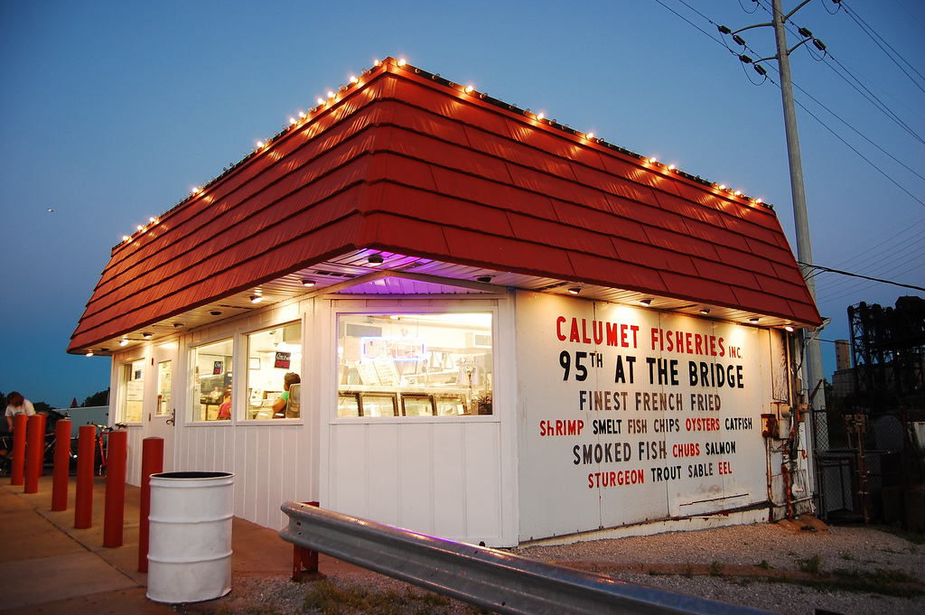
As a rule, all north-south streets within the city have names, not numbers. However on the Far Southeast Side (basically southeast of the awesome Calumet Fisheries seafood shack, located at 95th Street and the Calumet River), the north-south streets have letters. These start with Avenue O and go backwards down the alphabet as you head east to Avenue A, which forms the Illinois/Indiana border.
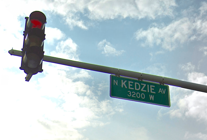
In general, there are eight full-sized city blocks per mile, which is reflected on street name signs and addresses. For example, Kedzie Avenue is a north-south street located four miles, or 32 full blocks, west of State. That’s why its street signs says “KEDZIE AV / 3200 W” Moreover, addresses on east-west streets on the first block west of Kedzie start at 3200 and increase as you head west. Addresses also increase as you go east of State, or north or south of Madison.
Confusingly, however, the eight-blocks-to-a-mile rule doesn’t hold true on the Near South Side, where the blocks are smaller. Roosevelt is 12 blocks south of Madison, so it should be 1.5 miles away, but the distance is actually only a mile. Cermak, is ten blocks south of Roosevelt, but it’s a mere mile away. And 31st Street is nine blocks south of Cermak, but the distance is only a mile. Therefore 31st, which, by the numbering system should be almost four miles south Madison, is only three miles away. Thankfully, the blocks and numbering system return to the usual rule for the rest of the city south of 31st.
Also confusing is that blocks are often subdivided, especially downtown. For example, Chicago Avenue, which is one mile north of Madison, is numbered 800 North, as it should be. However, since the blocks south of it are heavily subdivided, you cross 13 streets (and the Chicago River) while walking north to it from Madison along State, when you’d otherwise only cross seven.
The subdivided block thing is particularly a pitfall to navigation on the South Side, where an east-west roadway that subdivides the block between two consecutive numbered streets will have the same number as the street to the north. For example, the road between 43rd Street and 44th Street is 43rd Place. So if you’re having trouble finding an address on the South Side, make sure you’ve got the correct street suffix.
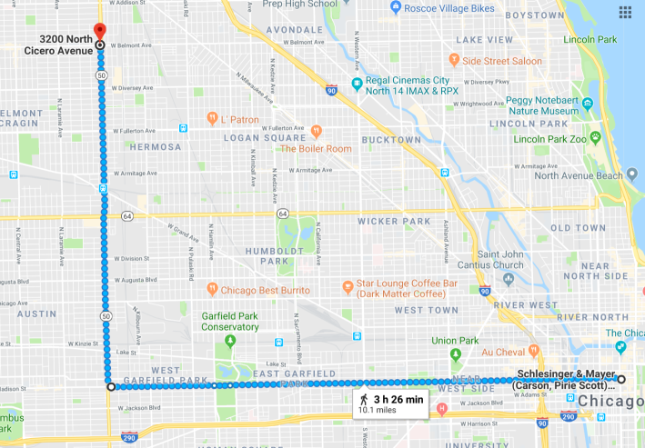
If all that sounds bewildering, rest assured that it’s actually pretty easy to figure out where an address is once you get familiar with the above rules, especially if you memorize how far from State or Madison major north-south streets, and east-west streets on the North Side, are located. For example, if you know that Belmont Avenue is 3200 North and Cicero Avenue is 4800 West, then you won’t have any trouble finding an address on the 3200 block of North Cicero, or calculating that it’s four miles north and six miles west of the Carson, Pirie, Scott and Company Building.
Also helpful is the fact that addresses on the north and west sides of streets are always even, while addresses on the south and east sides of streets are always odd. (Mnemonic: Florida, the southeasternmost state in the country, is also the oddest one. Hat-tip to Mike Fragassi for that one.)
But adding complexity to the street system is the fact that superimposed on Chicago’s relentless grid are a number of diagonal streets that radiate from the central city like spokes of a wheel. These are handy shortcuts, but it can be difficult to remember where they’re located until you’ve lived here a while, and the many six-way intersections can be dangerous and tricky to navigate. (The bustling junction of North, Damen, and Milwaukee avenues in the Wicker Park neighborhood was a notable example, which recently got some safety upgrades.)
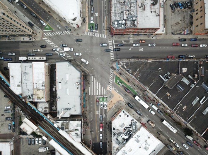
Heading clockwise from the South Lakefront, the major diagonals include South Chicago Avenue, Vincennes Avenue, Archer Avenue, Ogden Avenue, Grand Avenue, Milwaukee Avenue, Elston Avenue, Clybourn Avenue, Lincoln Avenue (seeing a pattern here?), and Clark Street (pattern broken.) Vincennes, Archer, Grand, Elston, and Clark were all built on or near longtime, if not ancient, Native American trails. Just about all of these streets (Archer being the main exception) are fairly bike-friendly nowadays, so they’re a good choice if you need to pedal downtown in a hurry.
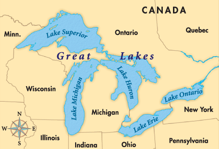
Here are a few more interesting facts and rules of thumb. South of Chicago Avenue, the next four east-west streets as you travel south are named after the Great Lakes, heading from west to east, minus Lake Michigan. (The lake Chicago sits on, of course, lends its name to Michigan Avenue, perhaps the city’s most famous north-south surface street.) So the streets are Superior Street, Huron Street, Erie Street, and Ontario Street.
Here's another block of streets that follow a theme. Heading south from Washington Street (one block north of Madison) several streets in a row are named after early U.S. presidents in semi-chronological order. These include Washington (George, first president); Madison (James, fourth); Monroe Street (James, fifth); Adams Street (John, second); Quincy Street (named for John Quincy Adams, sixth); Jackson Boulevard (Andrew, seventh); and Van Buren Street (Martin, eighth.) (The street named for third president Thomas Jefferson is a north-south thoroughfare west of the Chicago River.)
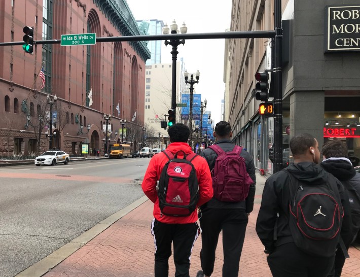
Notably, that streak of streets named for white, male presidents, some of whom were slaveholders, was broken on Monday, February 11, 2019, when Congress Parkway, the next street south of Van Buren, was renamed Ida B. Wells Drive in honor of the former slave, journalist, anti-lynching activist, and suffragist, who spent most of her life in Chicago. She was the first Black woman to be honored with a downtown Chicago Street name.
After that comes Harrison Street, named for William Henry Harrison, the ninth president. Tenth president John Tyler isn’t honored with a Chicago street name, likely because he served in the Confederate House of Representatives during the Civil War.
But after Harrison comes Balbo Drive, named for Italian aviator Italo Balbo, who became a hero to Chicago’s Italian-American community after he landed a transatlantic squadron of seaplanes here during the 1933 World’s Fair. However, nowadays Balbo has at least as bad a reputation as Tyler among many historians, because he’s also remembered as the Blackshirt leader who used brutal tactics to bring Benito Mussolini’s fascist regime to power.
After Balbo comes Polk Street (called 8th Street east of State) named for eleventh president James K. Polk. Next is 9th Street, followed by Taylor Street, which honors twelfth president Zachary Taylor. That’s followed by 11th Street, and then Roosevelt, a memorial to 26th president Theodore “Teddy” Roosevelt, which ends the presidential parade.
As far as I can tell, there’s no Chicago street named after Roosevelt's fifth cousin, 32nd president Franklin Delano Roosevelt – downtown Franklin Street and Franklin Boulevard on the West Side are reportedly named for Benjamin Franklin. Edit 2/15/19: Actually it turns out that there's a recently constructed street called Delano Court off of Roosevelt west of Clark, basically the driveway of the Roosevelt Collection mall -- see comments below.
On a personal note, not long after I moved to Chicago, I came up with a mnemonic to help me remember all the major east-west thoroughfares heading north from Belmont to Devon Avenue. I remembered the phrase “AIM Low For Better Precision, Dude” – each capital letter stands for the first letter of a street name: Addison (3600 North), Irving Park (4000 North), Montrose (4400 North) , Lawrence (4800 North) , Foster (5200 North), Bryn Mawr (5600 North), Peterson (6000 North), and Devon (6400 North).
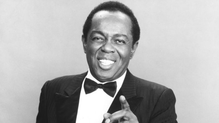
And Christopher J. Haid recently hipped me to an easy way to remember major north-south streets spaced a mile from each other west of State: the acronym HAWK. ("The Hawk" is the nickname for Chicago's cold winter wind that was made famous in soul singer Lou Rawl's song about growing up on the South Side, "Dead End Street.") There's Halsted Street (800 West), Ashland Avenue (1600 West), Western Avenue (2400 West), and Kedzie (3200 W).
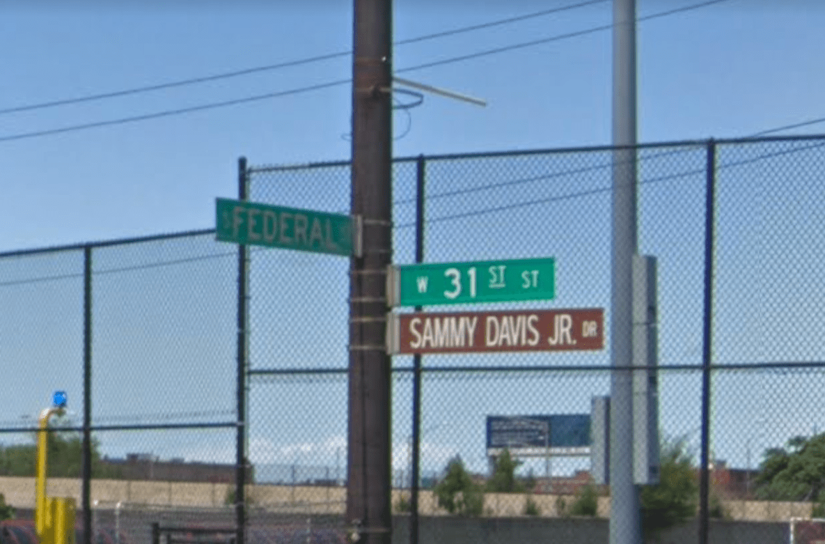
Here’s one final tip for newcomers and visitors to Chicago. Legitimate street name signs are green. Disregard the many brown honorary street signs, which can change from block to block, and are therefore fairly useless for navigation. But, hey, I’m glad that there’s a stretch of 31st Street in the Bronzeville neighborhood called “[Honorary] Sammy Davis Jr. Drive” (from Federal Street east to Lake Michigan) in honor of the legendary entertainer, so honorary street signs aren't all bad.
