All over the country, municipalities are reaping the safety and livability benefits of "road diets," reducing the number of travel lanes on overly wide streets to discourage speeding and make room for bike lanes and wider sidewalks. A common tactic is the "4-to-3 conversion," in which a four-lane road is converted to two travel lanes plus a turn lane, which studies show doesn't cause undue congestion on streets that average 20,000 daily trips or fewer. The remix of Lawrence Avenue in Ravenswood and Lincoln Square a few years ago was a good example of this strategy.
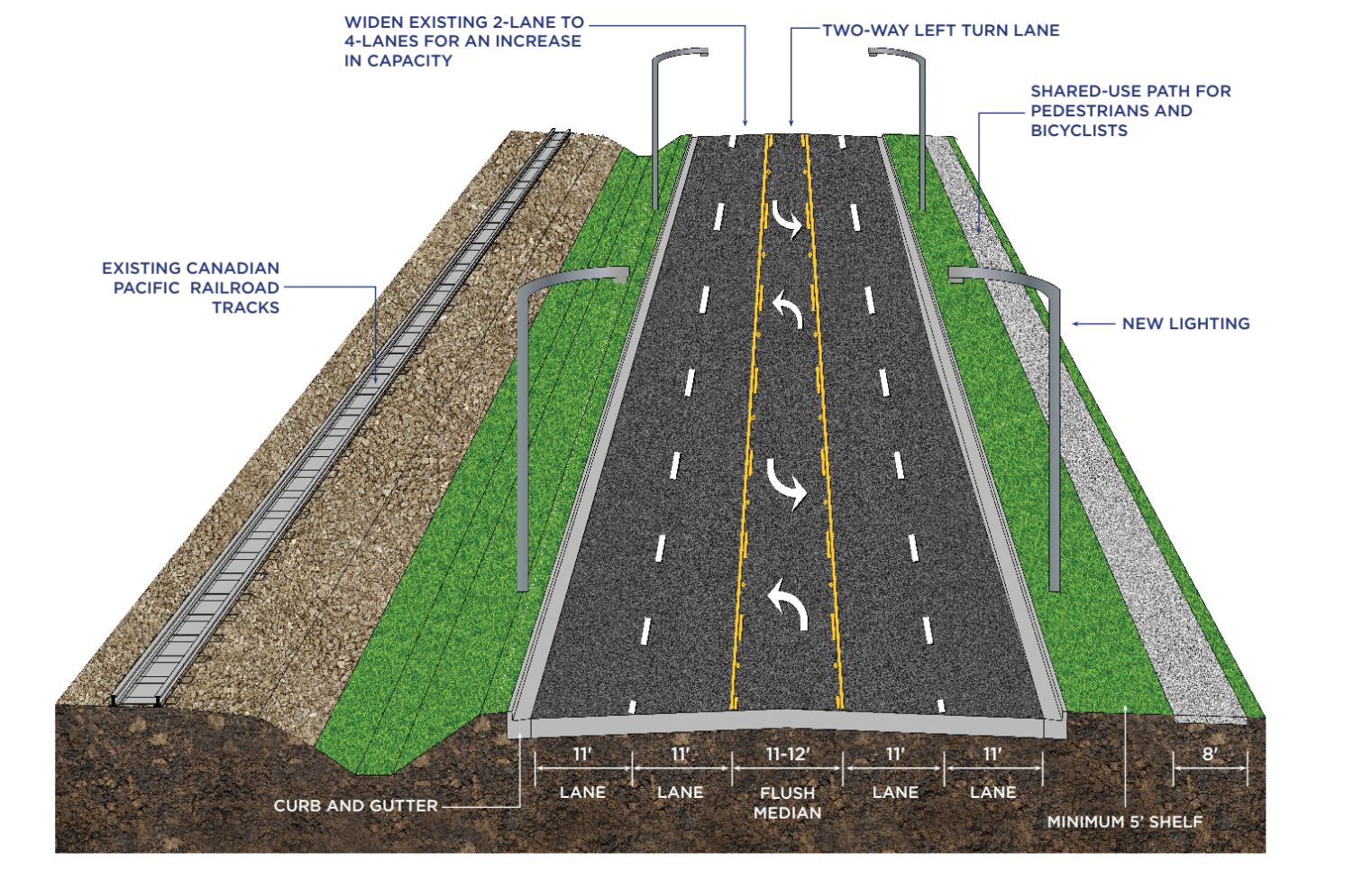
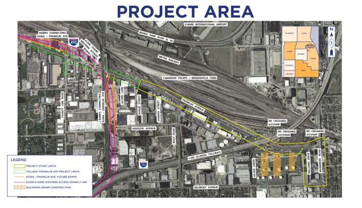
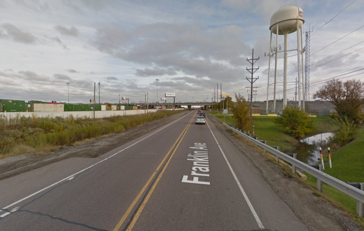
However, northwest-suburban Franklin Park, a village of about 18,000 people located directly south of O'Hare Airport, is taking the opposite approach by implementing a "road binge." They're planning to balloon a 1.8-mile stretch of Franklin Avenue, from Runge street to east of Mannheim Road, from the current two lanes to five. This stretch of Franklin is located just south of Illinois Route 19, aka Irving Park Road, the four-lane divided highway that wraps around the southern border of the airport.
"The safety of our residents and connectivity within our community are top priorities for the village," said Franklin Park mayor Barrett Pedersen in a statement. He added that the project will "[allow] traffic to flow more smoothly." In reality, more than doubling the capacity of the road will induce more driving and facilitate speeding. The project, which will cost $30 million in taxpayer money, mostly federal funds, is slated for construction between 2021 and 2023.
Granted, Franklin Avenue runs past an industrial area with higher-than-average truck traffic, about 20 percent of existing traffic. The project will create a new connection from I-294, the existing Interstate on the east side of O'Hare, with I-490, the new one being built on the west side of the airport. The mayor argues that, thanks to the Frank Avenue widening, "our community will enjoy new regional connectivity."
The project includes new and updated traffic signals at several intersection, and improved street lighting throughout the corridor. Franklin Park officials also tout the road expansion as a win for pedestrians and cyclists because it will include a mixed-use side path in a location that currently has no sidewalks. However, it's not clear that many people will want to bike along a five-lane road, on a stretch that doesn't connect with any existing bikeways.
All parts of the project area currently average fewer than 14,000 trips per day (fewer than 8,000 at the eastern end), so the two-lane road is the appropriate size for the amount of traffic it currently carries. It's true that the impending expansion of O'Hare may generate additional traffic, so perhaps adding a turn lane might be warranted in the future.
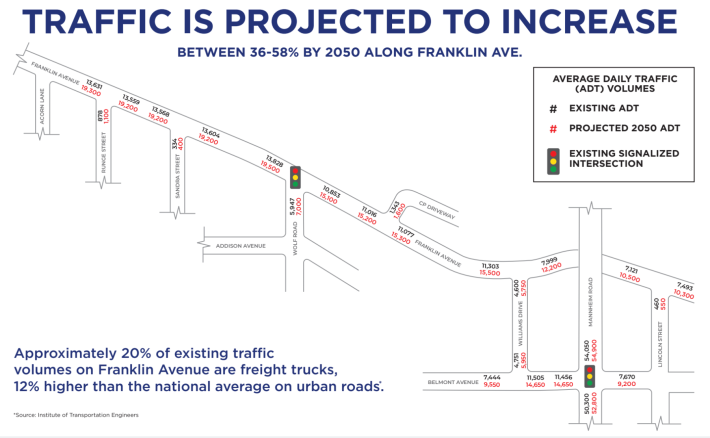
But officials are justifying the expansion to five lanes with projections that traffic on this stretch will increase by 36-58 percent by 2050. That's a self-fulfilling prophesy. If Franklin Avenue is widened by 250 percent, the greatly increased capacity will encourage a heck of a lot more people to drive on it, a phenomenon called induced demand. If you build it, they will come.
But it appears that Mayor Pedersen and other Franklin Park decision-makers are proud that they're going to enable a lot more motorists to drive a lot faster through their town.