Despite what the yellow signs say, if you want your Chicago bike trip to be as pleasant as possible, I suggest you don't "share the road" with drivers. I’m not saying you should be a jerk to motorists, but rather that you should consider opting out of riding on our city's hectic, car-choked arterials in favor of peaceful low-traffic side streets.
Don’t get me wrong: We're fortunate that the Chicago Department of Transportation has installed some 300 miles of on-street bikeways, mostly along retail corridors. When you're in a hurry, sometimes direct routes like Archer or Milwaukee (the "hipster highway") are the most practical choice for pedaling. CDOT's official bike map is a handy resource for locating marked main-street bikeways.
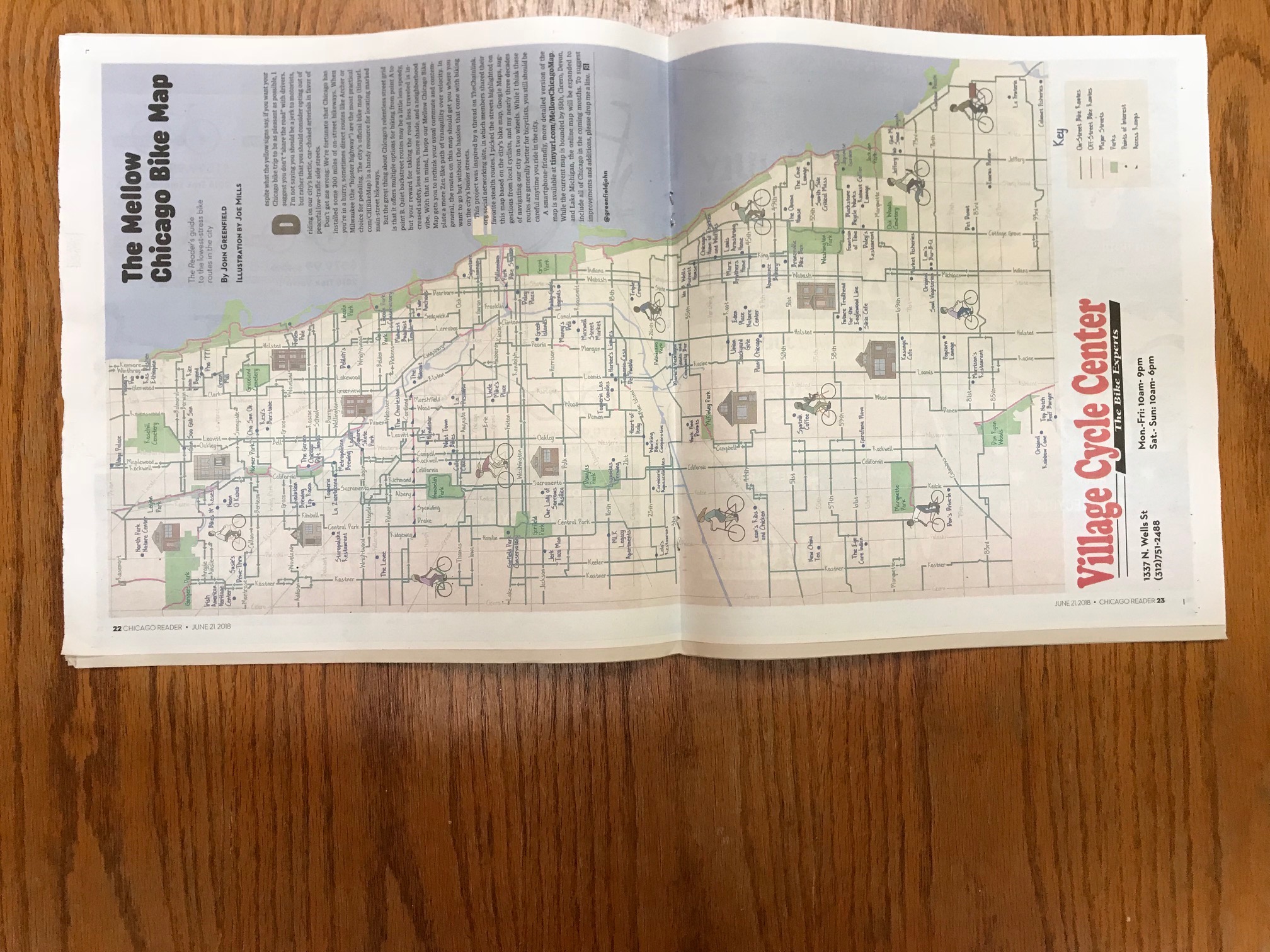
But the great thing about Chicago's relentless street grid is that it offers multiple options for biking from point A to point B. Quiet backstreet routes may be a little less speedy, but your reward for taking the road less traveled is increased safety, less stress, more shade, and a neighborhood vibe. With that in mind, I hope our Mellow Chicago Bike Map gets you to rethink your usual commute and contemplate a more Zen-like path of tranquility over velocity.
This project was inspired by a thread on TheChainlink.org social networking site, in which members shared their favorite stealth routes. I picked the streets highlighted on this map based on the city's bike map, Google Maps, suggestions from local cyclists, and my nearly three decades of navigating our city on two wheels.
A nicely illustrated, two-page pull-out version of the map by Joe Mills, suitable for hanging on the wall or carrying with you as a quick reference, runs in the issue of the Chicago Reader weekly newspaper that hits the streets today. You can pick it up for free at the yellow newspaper boxes with a big, backwards "R" on the side, as well as libraries, cafes, bars, and other retail locations.
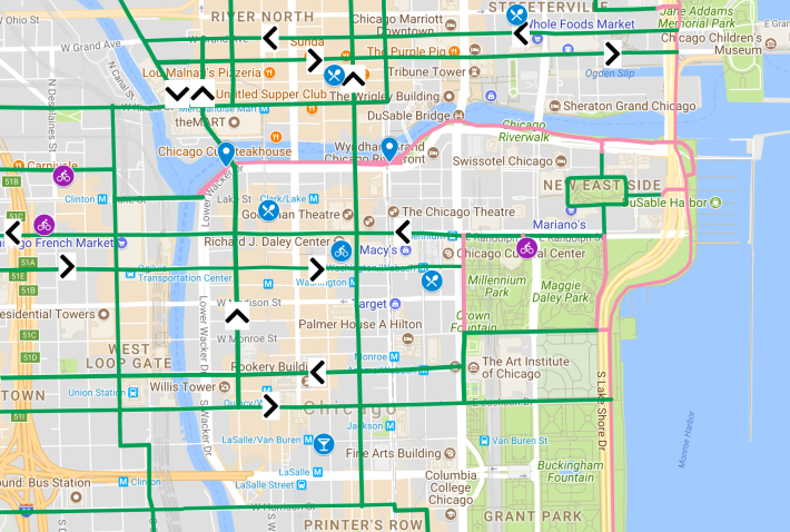
A more detailed and evolving version of the map is available as an interactive, smartphone-friendly Google Map, embedded in this Reader post: Tinyurl.com/MellowChicagoMap.
While the current Mellow Chicago map is bounded by 95th, Cicero, Devon, and Lake Michigan, the online map will be expanded to include all of Chicago by September 1. To suggest improvements and additions, please drop me a line on Twitter at @greenfieldjohn or leave a comment below.

Some notes on the map:
—I’ve tried to create a grid of low-stress north-south and east-west routes spaced roughly a mile apart. In some cases I've included additional itineraries that were too useful or enjoyable to leave off the map.
—To keep the map from getting too cluttered, main-street bikeways, including most diagonal streets, generally aren't shown on the illustrated map or the initial view of the Google Map —check out the CDOT map for details on these. You can also click a layer on the Google Map labeled "Other main-street bike routes" to make these visible.
—Some routes cross two-lane main streets at intersections with no traffic signals or four-way stop signs. Please take a "stop and look both ways before you cross the street" approach here.
—Some routes include a short stretch of sidewalk, or a "wrong-way" block. To follow the letter of the law, please dismount and walk your bike at these locations.
Thanks to the following people who have helped out with the print and/or online versions of the map: Elihu Blanks, Shawn Conley, Angela Ford, Carolina Gallo, David Griggs, Katherine Hodges, Derrick James, Howard Kaplan, Gin Kilgore, Lynda Lopez, Jake Malooley, Danielle McKinney, Beth Medley, James Porter, Anjulie Rao, Eric Allix Rogers, Bill Savage, Yasmeen Schuller, Brian Sobolak, Peter Taylor, and Vera Videnovich. The route connecting West Town Bikes, the Bloomingdale Trail, the Logan Square Skate Park, and the Garden Chicago Dirt Jumps was originally brainstormed by students from West Town Bikes and is known as "The Circuit."
As part of Active Trans' Chicago Bike Week 2018, presented by Freeman Kevenides Law Firm (a Streetsblog Chicago sponsor) I'll be celebrating the release of the bike map with “Chicago’s Mellowest Bike Tour.” The ride meets at the Picasso sculpture in Daley Plaza, 50 W. Washington, at 5:45 p.m., departing at 6 p.m. The roughly 12-mile, two-hour tour will showcase peaceful side street routes, trails and protected bike lanes in central Chicago neighborhoods. Highlights will include a mural-lined route on a quiet Pilsen street, an under-the-radar river path in River North, a tranquil route to the lake in Old Town, and a low-stress stealth route from the Lakefront Trail to the Millennium Park bike station.


