This article also ran in the Chicago Reader weekly newspaper.
Toronto's late mayor Rob Ford was notorious for his cocaine consumption, but there were some other white lines he didn't care for. The Chris Farley-esque politician, who famously called bicyclists "a pain in the ass to motorists," made a point of having existing bike lanes removed to create more room for cars. This led to a memorable showdown in 2012, when protesters temporarily stopped the removal of the Jarvis Street bike lanes by laying down in the street to block the pavement-scraping machine.
But when I visited "the Six" (as Toronto native Drake calls the city) earlier this month, I found that post-Ford Toronto is a highly bikeable place. It even has a network of high-quality protected bike lanes with features that Chicago would be wise to emulate.
In some ways Toronto is a parallel universe to Chicago. They're both cold, northern cities on Great Lakes, with consistent street grids and generally flat terrain (although Toronto slopes downward towards Lake Ontario).
Canada's largest city recently overtook Chicago to become the fourth-most populous city in North America, with 2.83 million residents as of 2015, slightly more than our 2.72 million inhabitants. But since more than 100,000 immigrants settle in the Toronto area annually—about half of the city's population is foreign-born—while Chicago lost about 2,890 residents in 2015, that gap is likely to grow in the future.
And since Toronto is a sister city to Chicago, there's been some sharing of ideas when it comes to improving conditions for biking. The Chicago Department of Transportation's Bicycling Ambassadors outreach team was directly modeled after Toronto's Road and Trail Ambassador program.
There's been some friendly competition between the cities too. In the early 2000s, when I worked as CDOT's bike-parking czar, Toronto was my white whale. Even though Chicago had installed more bike racks than any other U.S. city, Toronto had put in a few thousand more of their distinctive "post-and-ring" parking units. The current tally is about 15,000 Chicago racks to more than 17,000 in Toronto. Annoying, eh?
Much more importantly, our neighbor to the north has us beat when it comes to traffic safety. Chicago averaged about six bicycle fatalities annually between 2009 and 2014, but Toronto typically only sees between one and four fatal bike crashes a year, according to Jacquelyn Hayward Gulati, who manages cycling infrastructure programs for the city. And while Chicago averaged roughly 110 total traffic fatalities annually between 2010 and 2014, Toronto has only about 50 traffic deaths a year, Gulati says.
She didn't have an explanation for the discrepancy. Toronto has its fair share of wide roads—University Avenue, where my hotel was, had eight lanes of traffic—although unlike Chicago, the central city isn't carved up by expressways. Anecdotally, it seemed to me that traffic was a lot mellower in downtown Toronto than it is in the Loop, with a minimum of excessive speeding, swerving between lanes, and gunning towards yellow lights. I'm tempted to chalk it up to stereotypical Canadian courtesy.
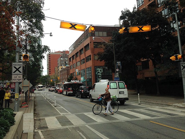
Toronto also has some solid walking and transit infrastructure. Respect for pedestrians is evidenced by bright yellow beacons with black Xs on them, strung over midblock crosswalks. When you push a button to cross, the lights are activated, reminding drivers that they're required to stop for you.
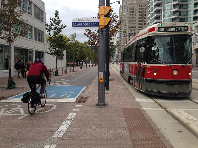
Another distinctive feature of the city's transit system is the many streetcar lines, whose bright-red cars offer a smoother, more civilized ride than a bus—although the tracks present a hazard for cyclists. While some lines run in mixed traffic, meaning they aren't any faster than a typical CTA bus, a few lines, such as the one on Spadina Street, have dedicated right-of-way.
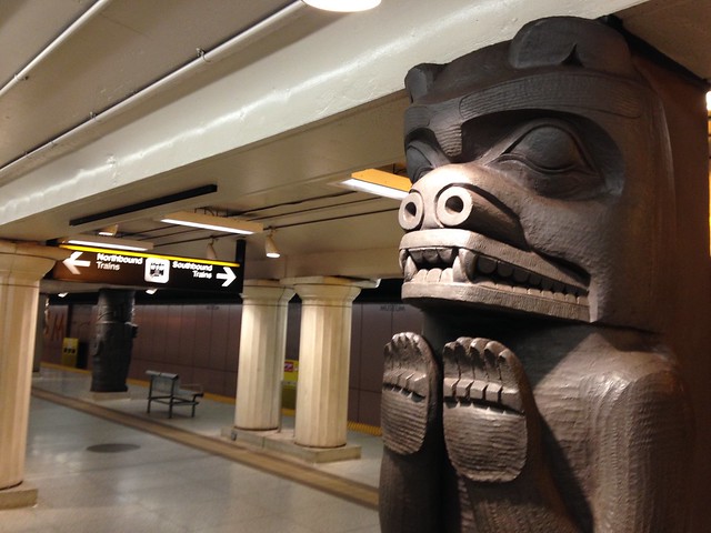
And while Toronto's subway system isn't as extensive as the el, the sleek, spacious rail cars put our 70s-style rolling stock to shame. Transit geeks should be sure to visit the platform at the Royal Ontario Museum station, where the columns are reproductions of Egyptian sarcophagi and First Nations bear carvings. Two new light rail lines are currently planned.
Even though Ford once dismissed urban cycling as a suicidal endeavor akin to "swimming with sharks," the belief that Toronto became a worse place to bike during the Ford era is a misconception, Gulati says. Although there were three cases where bike lanes were ground out to facilitate driving, bikeways were built on parallel roads as alternatives.
Moreover, under pressure from advocacy groups like Cycle Toronto, the city began building a network of protected lanes. "So, actually, quite a bit was achieved for cycling during that time," Gulati says. To prove it to me, she provided an itinerary for a roughly nine-mile loop around the central city, almost exclusively on buffered and protected bike lanes, traffic-calmed "local street bikeways" (known as "neighborhood greenways" in Chicago), and off-street paths. I was impressed by what I saw.
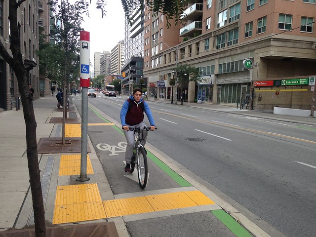
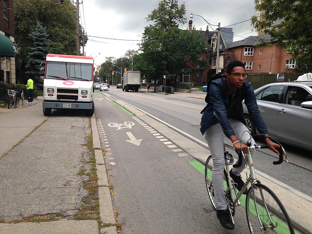
On Sherbourne Street, sidewalk-level raised bike lanes were built to replace the Ford-abolished lanes on nearby Jarvis. Unlike Chicago's sole experiment with raised lanes, which only exist on a couple of blocks on Roosevelt Road east of State Street, the Sherbourne lanes run for about two miles, keeping cyclists safely above car traffic. It would be great to see CDOT build raised lanes that were more than just a demonstration project.
Interestingly, in places where the Sherbourn lanes pass through bus stops, yellow textured tiles, similar to the material on the edge of train platforms, have been installed to discourage waiting bus riders from standing in the bikeway. I also encountered some nice curb-protected lanes along Toronto's Wellesley Street, and passing through the lush Queen's Park green space by the University of Toronto.
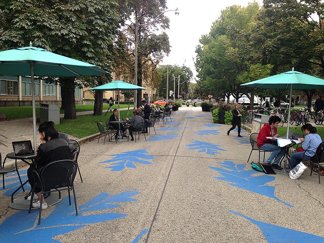
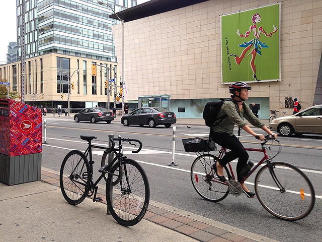
Bloor Street, a busy east-west thoroughfare lined with funky mom-and-pop businesses and the quirky Bata Shoe Museum, recently got protected lanes on a trial basis. The city removed one mixed-traffic lane, as well as a parking lane on some blocks, to make room for the bikeway.
The pilot runs until fall 2017, at which point the lanes could theoretically be taken out. But I saw so much bike traffic on the street, I'm sure the city would have another civil disobedience situation on its hands if it tried. I'd like to see CDOT take a similar approach by implementing politically challenging bike lanes on a test basis.
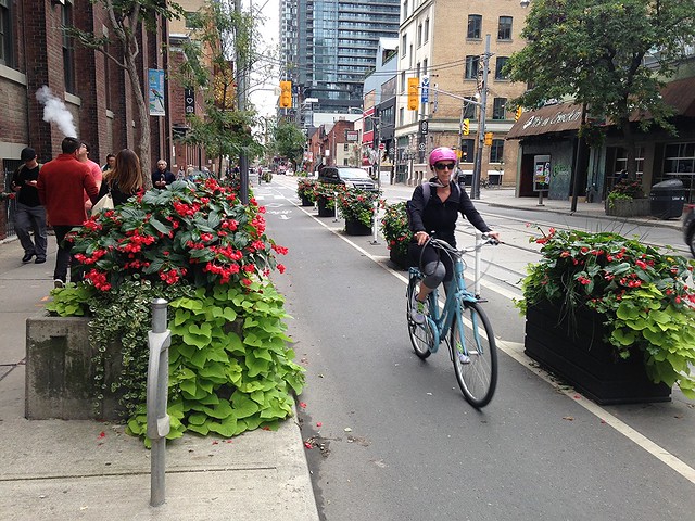
Another forward-thinking bikeway strategy was the protected lanes I encountered on Adelaide Street, which are lined with heavy planter boxes filled with colorful flowers. In the winter the plantings are replaced with evergreens and pine cones, Gulati says.
My route concluded on Queen's Quay, a harborfront (sorry, "harbourfront") street that also recently underwent a road diet. Two of its four travel lanes were converted to make room for wider sidewalks, street trees, expanded plazas, and a new off-street path that sees up to 6,000 cyclists a day during nice weather, according to Gulati.
Next, I caught a ride from the Jack Layton Ferry Terminal to the car-free Toronto Islands, bringing along my Toronto Bike Share cycle. That's one department where Chicago dominates; while the Divvy system currently has more than 5,800 bikes, TBS has only 2,000.
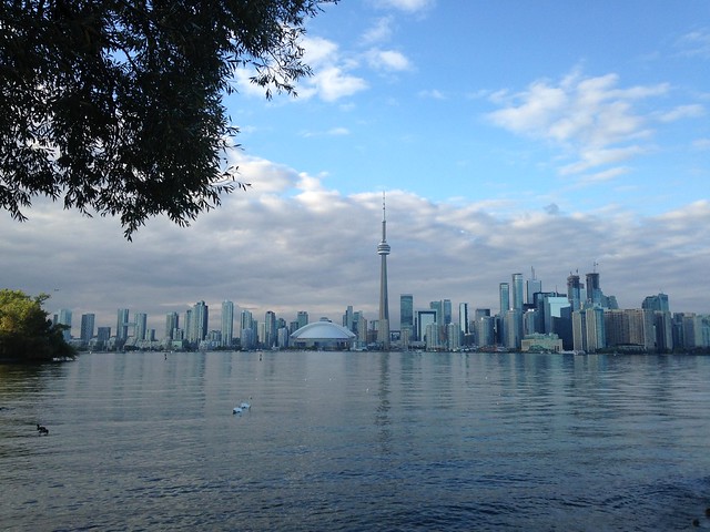
After a gray day of riding, the sky cleared up once I reached Ward's Island, and I was treated to a transcendentally beautiful view of the skyline, including the needlelike CN Tower, which is, appropriately, featured on the cover of Views, Drake's latest album. (Yes, it's touristy, but if you've never been to the Six, you'll want to ride one of the scary-fast elevators to the top for the paronrama—trust me.)
Hopefully CDOT will soon try some of Toronto's more progressive strategies, such as building long stretches of raised bike lanes, using planters to protect lanes, and installing politically risky bikeways on a trial basis. It would be a shame to let our sister city continue to show us up in these departments.
See more of my photos of Toronto transportation facilities here.
