Over the past few years the city has built a handful of "neighborhood greenways," projects that involve small changes to side streets that can have a big impact in making them more bikeable, while connecting residential areas to the wider network of bike lanes. If the Chicago Department of Transportation picks up the pace on building these bikeways, it could actually create the kind of "8 to 80" bike network that the department says is its goal, and the Active Transportation Alliance and other advocates have been pushing for.
Neighborhood greenways can involve a number of different strategies that discourage cut-through traffic and speeding on residential streets, while making cycling more efficient and comfortable. For example, Chicago's first neighborhood greenway on Berteau between Lincoln and Clark, completed in 2013, involved removing four-way stop signs at an intersection and replaced them with a traffic circle. This forces drivers to slow down to maneuver around the circle, but it doesn't hinder bicyclists.
The Berteau route also includes sections of contraflow bike lane that allow two-way cycling on one-way segments of the street; a reduced 20 mph speed limit; curb bump-outs that shorten crossing distances for pedestrians and discourage fast turns by drivers; and a pedestrian island at Clark with a special cut-through that allows eastbound contraflow bike traffic to turn north onto Clark.
However, the city's second neighborhood greenway, completed in 2014 on Wood Street between Augusta and Milwaukee, doesn't include any concrete infrastructure but only street markings. As such, the project was less effective making the street more bike-friendly. A bike infrastructure design from the Netherlands offers inspiration for additional changes that could be made to Wood that would emphasize the greenway's role in the network and pilot a new kind of traffic calming in Chicago.
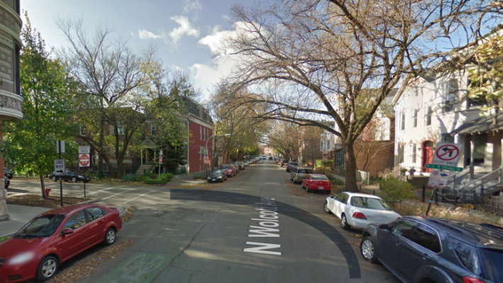
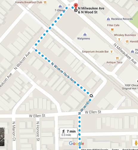
The Wood bike route makes three turns at Ellen, Wicker Park Avenue, and Wolcott – all within the span of two blocks. At the tricky "T" intersection of Wicker Park and Wolcott, bicyclists aren't given any sort of priority.
Southbound bicyclists have to make a left turn from Wolcott to Wicker Park Ave. Signs here tell southbound cyclists that the greenway continues to the left, but they're placed too close to the intersection. By the time a cyclist is close enough to read the sign and realize they need to turn left, it's a little too late to conveniently merge left, and it's also necessary to yield to oncoming traffic on Wolcott before turning. I'd argue that this doesn't embody the safe and comfortable riding experience you're supposed to enjoy on an neighborhood greenway.
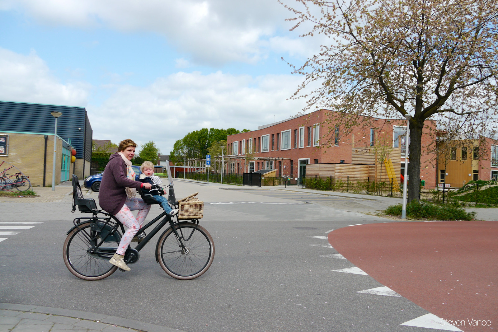
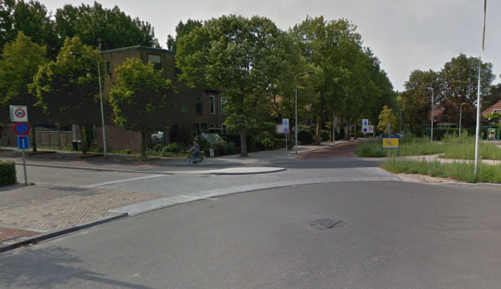
In contrast, when you're biking on a Dutch "fietsstraat" (bicycle street) in a town like Nijmegen (nigh-may-hen), cycling is prioritized even when the bike route turns from one street to another at a "T" intersection. This is indicated with signs and the red pavement – kind of like a red carpet – which is used throughout the Netherlands to denote bike-priority and bike-only routes. As the bikeway turns from one street to another at an intersection, the red pavement does, too.
"Shark's teeth," white triangular street markings that point in the opposite direction of traffic, indicate that those cyclists and motorists outside the red pavement must yield to those riding and driving on the red route.

When a street is designated as a fietsstraat, motorists are prohibited from passing bicyclists in residential areas. While we don't have a law like that on the books in Chicago, there are other strategies we could use to improve our neighborhood greenways that are already in our toolbox.
The Berteau and Wood Greenways include some stretches where the bike route is painted green, such as on the contraflow lanes, and other locations where there are merely bike-and-chevron "sharrow" symbols. Painting an entire bike lane along the route green would make wayfinding easier for bike riders, and help ensure that drivers are looking out for cyclists.
I feel the wayfinding signs along our greenways could also be improved. Right now a sign might say "Chicago Avenue [arrow pointing in the direction of Chicago]," using a cross-street as an arbitrary destination. It would be more effective for the signs to say, for example, "Wood Street Greenway [arrow pointing in the direction of the bike route]" to make it clear that cyclists need to make a turn in order to stay on the bike-friendly route.

Another nice tweak to the Wood greenway would be to relocate the stop signs at Wicker Park/Wolcott. As it is, traffic heading northwest on Wicker Park must stop for traffic heading north on Wolcott. If we prioritized Wicker Park instead, northbound cyclists could make an unhindered right turn from Wicker Park to Wolcott, and southbound riders could make an unhindered left turn from Wolcott onto Wicker Park. This traffic pattern change would be paired with colored pavement to make it obvious who has priority at this intersection.
Finally, the pavement on Wolcott has deteriorated to the point that it's at best an annoyance for cyclists and at worst a hazard. CDOT should repave this street as soon as possible, and when they do, they could add a short, curved curb, paralleling the turn southbound cyclists make from Wolcott to Wicker Park, as illustrated in the photo above. The curb would be the edge of a raised crosswalk, too, giving pedestrians and wheelchair users a level surface on which to cross the street. This would encourage motorists who aren't driving on the greenway way route to proceed at a slow speed.
CDOT has plans to extend the Wood Street greenway from its northern terminus at Milwaukee about a half mile north to Cortland. Although upgrading the Wood greenway south of Milwaukee isn't in the scope of the upcoming project, scope is an artificial limit. By making the improvements I've described, CDOT could create a safer, more user-friendly bike route.


