I went on a 25-mile bike ride yesterday to check up on livable streets projects around the city (final destination: Lao Beijing for dried chili chicken). On the trip I got a good look at the restriped bike lanes on King Drive in Bronzeville, the conversion of the Garfield Green Line station to a Green/Red/shuttle bus super station, the Red Line South reconstruction project, and lots of Divvy bike-share stations. I spotted three new Divvy locations and since my ride have heard about three more. Add the original Daley Plaza station and there are at least seven installed. Here's a quick recap of where you can find Divvy stations so far, and in a separate post I'll give a status report on the other projects.
Divvy stations can be found at:
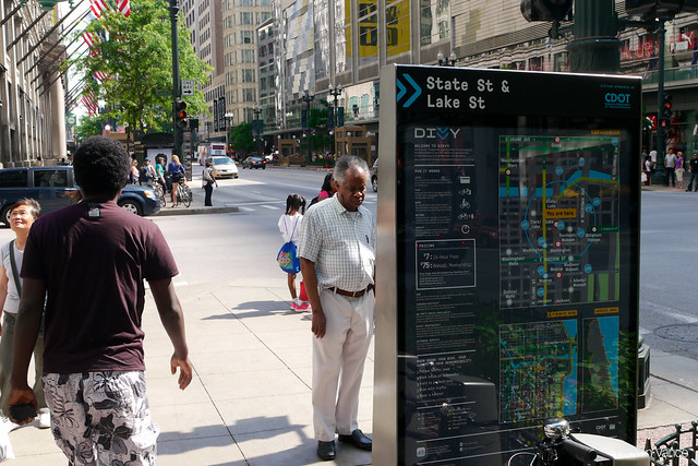
- Randolph and State, in front of Walgreens on the State Street sidewalk
- Daley Plaza (the original, on the Washington Street sidewalk)
- Chase Plaza at the subway entrance to the Blue Line, on the Dearborn Street sidewalk
- Federal Plaza by the post office, on the Adams Street sidewalk
- Via Twitter: Washington and Clinton, Wells and Walton/Oak (one, two, three), and Larrabee and Kingsbury
The pace of installation should pick up. At a meeting last week, Chicago Department of Transportation Assistant Commissioner Sean Wiedel said that after Thursday and Friday, installations would move at a pace of eight per day.
The kiosks are attracting a lot of attention. At the State and Randolph location, I overheard one woman telling her son, "$7 [for the 24-hour pass], that's okay." Curiously, some of the stations' names don't quite match their locations. The station at Randolph and State, for instance, is called "State St & Lake St," likely to link it with the nearby 'L' station nearby.
The maps on the kiosks will be a helpful new addition to downtown wayfinding, but they could use some improvement. Removing overlapping labels, reducing the prominence of alleys, and moving the legend closer to the map would make them more legible and useful.
