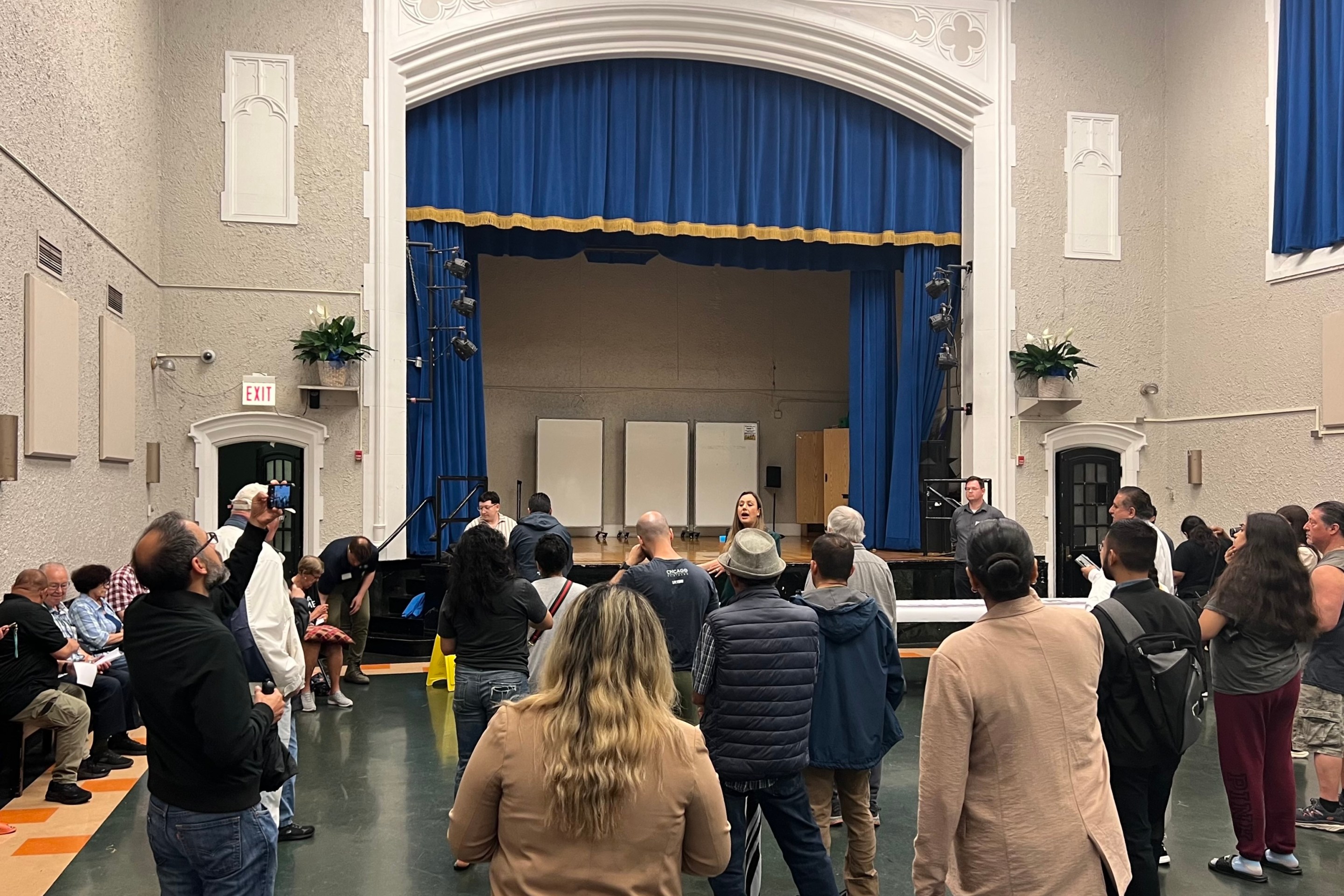
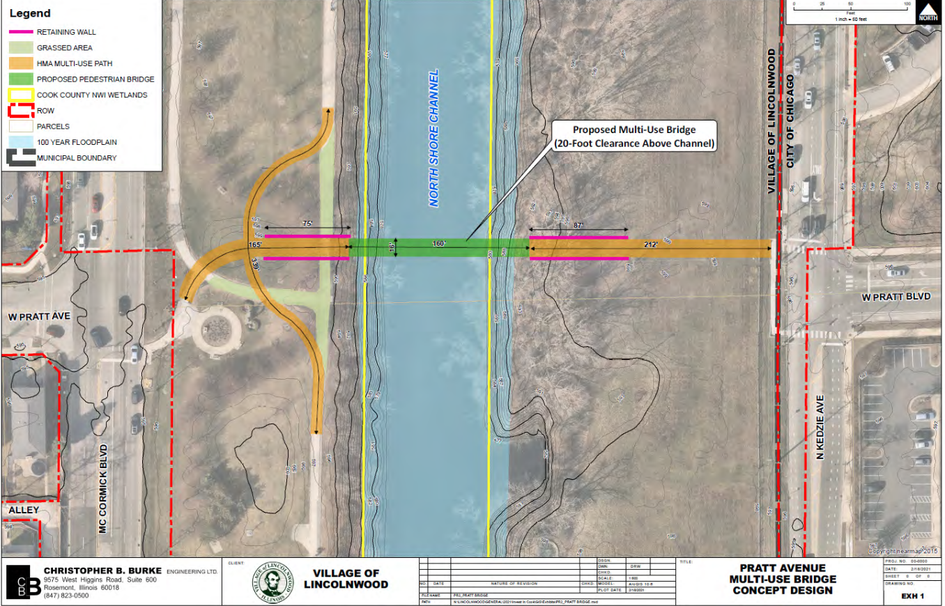
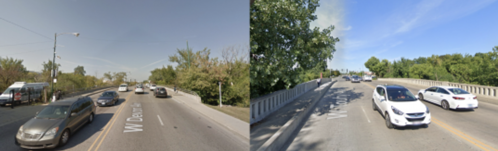
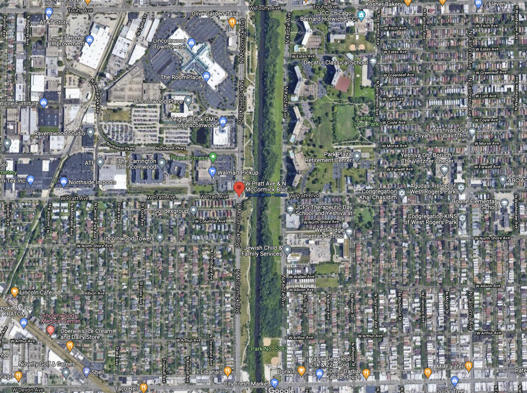
When the news came out that Lincolnwood is planning to build a bike-pedestrian bridge over the North Shore Channel at Pratt Avenue (6800 N.), connecting the suburb to Chicago's West Ridge neighborhood, aka West Rogers Park, my sense was that there was general rejoicing from the local bike community. After all the bridge will improve access to the North Shore Channel Trail, located on the west side of the waterway, filling the unusually long one-mile gap between the vehicular bridges on Devon (6400 N.) and Touhy (7200 N.) avenues, which are both bike-hostile four-lane roads.
The bridge will also greatly improve pedestrian access between the suburban village and the Chicago neighborhood. That will be especially useful because both communities have large strict Orthodox Jewish communities, whose members typically only walk for transportation during the Sabbath, between sundowns on Friday and Saturday.
There have been calls for building the bridge since at least the early 1970s, but years ago there was opposition from Lincolnwood residents, reportedly because they didn’t like the idea of making it easier for Chicagoans to access the village. Progress has been made since then, including the construction of the Valley Line and Union Pacific trails in the suburb, so there seems to be more support for the span from Lincolnwood residents. But sadly, that anti-outsiders attitude hasn't completely died out, judging from a comment on our last article on the bridge proposal: "Stop this bridge, not needed, will bring increase in crime to Lincolnwood."
But I was more surprised to read comments opposed to this project to encourage trail use and cycling from an unlikely source: nature lovers and bike shop owners.
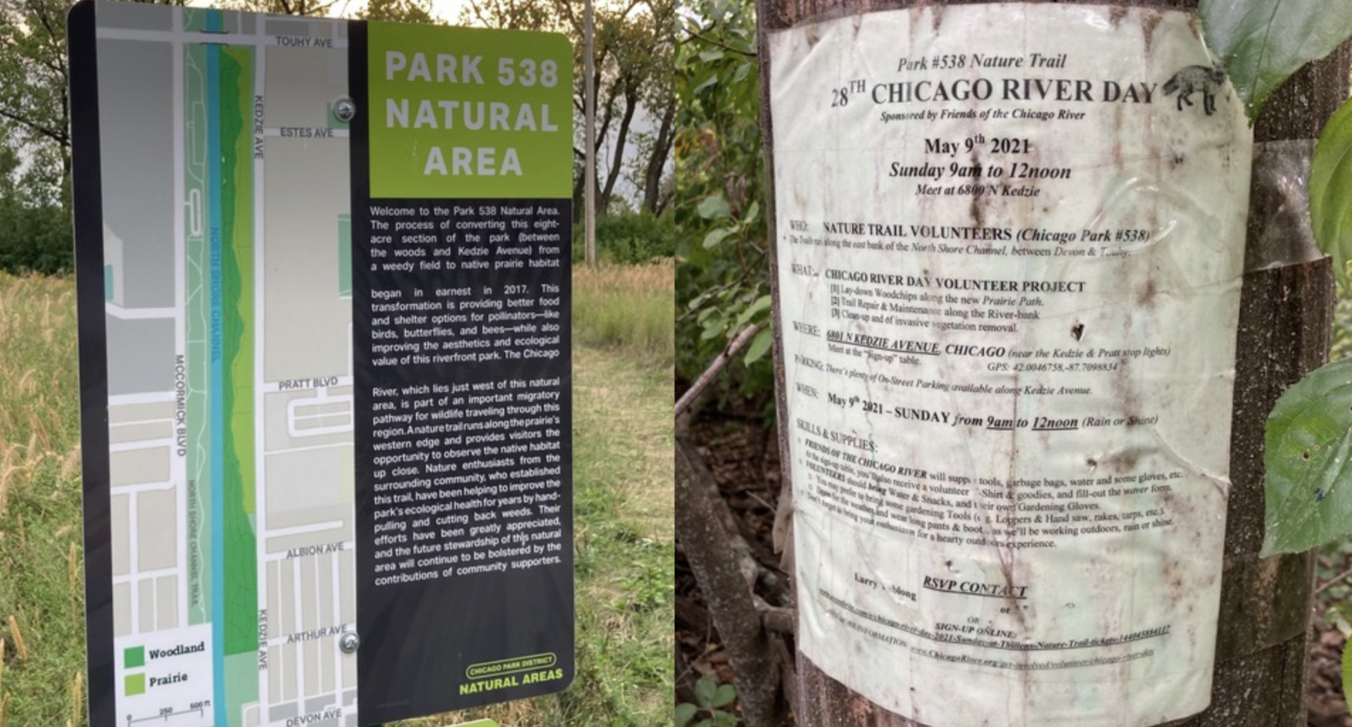
On the east side of the channel lies Chicago Park 538, eight acres of recently-restored prairie west of Kedzie Avenue (3200 W.), as well as a wooded area right next to the water with dirt trails running through it. Larry Yablong, who leads trail maintenance days, argued that the bridge would disturb the natural environment. "This 16-foot wide bridge will ruin the nine acres of natural prairie that is just now beginning to blossom. How would we organize to STOP this project?"
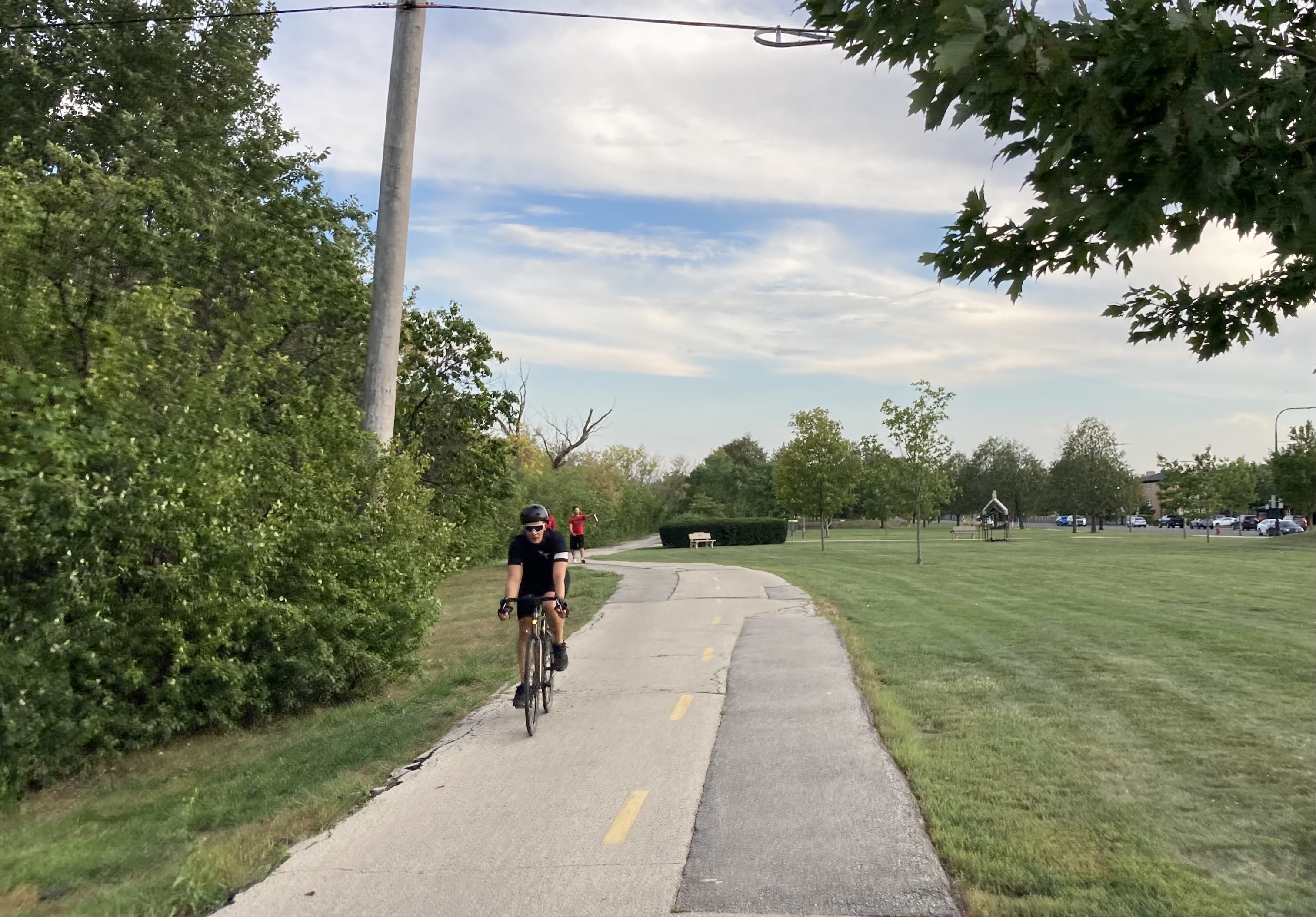
Even more surprising were comments from my old friends and bike shop coworkers Kevin Womac, who owns Boulevard Bikes in Logan Square, and Ezra Hozinsky, owner of Green Machine Cycles in Ravenswood. "Don't get me wrong – I like bike infrastructure," Kevin wrote. "But I love getting away from people even more. The stretch of forest, from Touhy to Thillens Stadium (almost Devon) on the east bank of the channel has a wonderful network of trails. It will be a bummer to interrupt the tranquility with the concrete and steel of even a modest pedestrian bridge."
Kevin noted that for cyclists riding east or west on Pratt, detouring south to Devon or north to Touhy to cross the channel and then back to Pratt only adds a mile to the trip. But, again, those streets aren't really safe to bike on, and a mile detour is annoying on a bike if you're trying to get somewhere. For a pedestrian, it adds a potentially-deal-breaking 20 minutes or so to a journey.
Ezra seconded Kevin. "The sight lines and enjoyment of Park Number 538 would be damaged by a bridge. If the motivation is to support the Lincolnwood [Town Center] shopping center [on the west side of the channel between Pratt and Touhy], those stores could provide a shuttle service to people finding it difficult to navigate the walking distances, or Chicago could rezone an area near the Pratt/Kedzie intersection for commercial use if better access to shopping is truly necessary." There are several senior housing high-rises on the east side of Kedzie north of Pratt, and the areas southwest and east of the bridge location are mostly residential.
Kevin later invited me to tour the area with him on bikes. He argued that there isn't much latent demand for pedestrian access across the channel at Pratt. "On the west side at Pratt is a car dealership," he wrote. "A block south is a Walmart and a Planet Fitness, with a sea of parking between them. No one is walking there. It's a boondoggle."
However, the shopping area also includes a Lowe's home improvement store, several restaurants, and many other retail outlets, which residents on the east side of the channel might choose to walk or bike to, if there was a pleasant route. Kevin was also underestimating the utility of pedestrian and bike access to the many synagogues and yeshivas, private religious schools, on the east side of the waterway. For example families in Lincolnwood might allow their kids to walk or bike to school in West Ridge if there was a safe route, rather than driving them there.
"But most important is the mile of uninterrupted preserve on the east bank, with probably two miles of trail, all twisting and turning in the forest," Kevin argued. "And aside the forest is a prairie. Blasting out a chunk of this for an unnecessary bridge will affect its mojo for good."
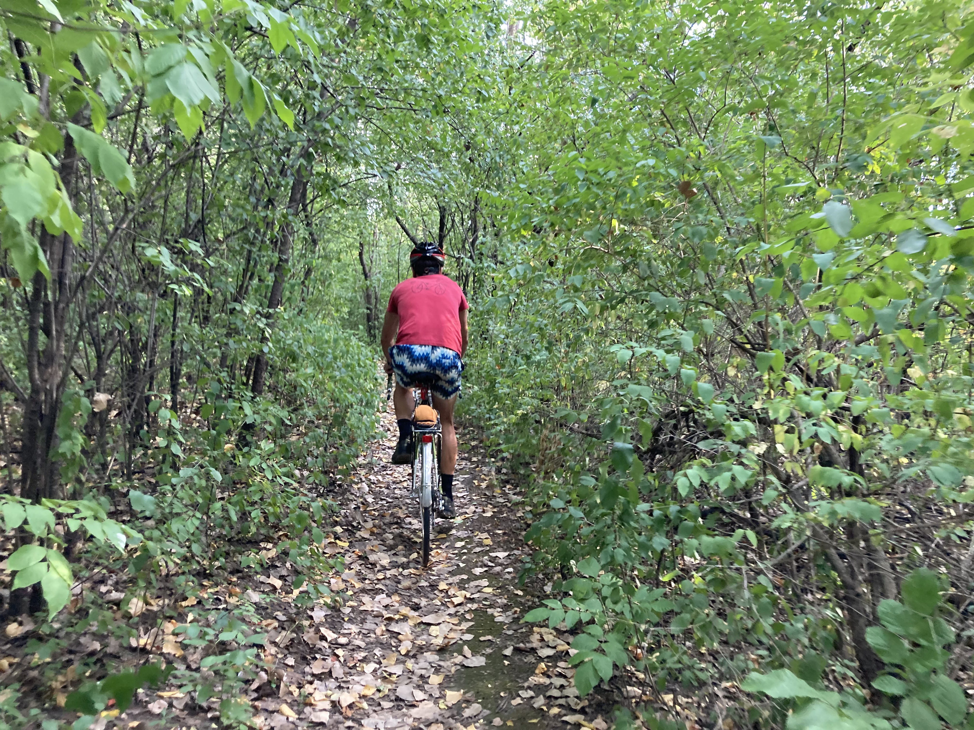
During our bike ride, I saw that the trails through the forest are, indeed, a special, overlooked place to cycle or stroll. But while the construction of the bridge will cause some disruption to the prairie restoration efforts, and the forest trail will become a little less clandestine, my conclusion is still that the arguments against building the bridge don't outweigh the positives: safer, more convenient, and more pleasant east-west bike and pedestrian access.