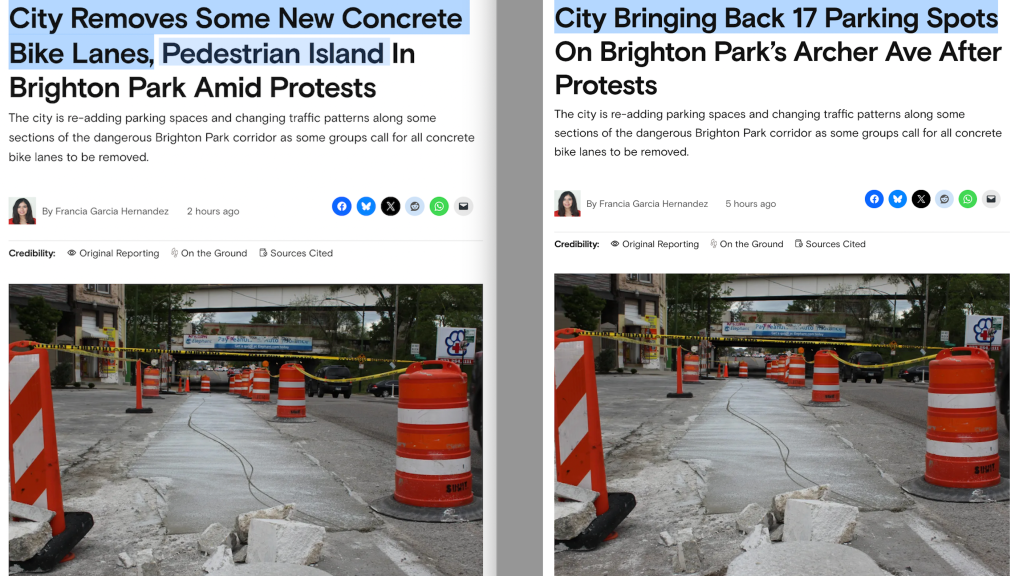
Obama Center work starts this summer. What does the plan mean for transportation?
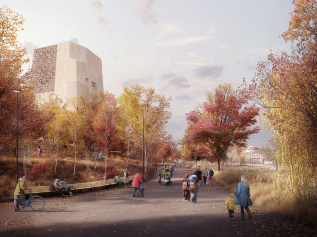
After a multi-year, long-delayed approval process, the controversial Obama Presidential Center has finally been cleared by the feds to start construction as early as this August. Leaders like former president Barack Obama and Chicago mayor Lori Lightfoot promise the project will revitalize Jackson Park and create new job opportunities for South Siders.
But the initiative has also seen a backlash from some Chicagoans who argued it should be located elsewhere, such as Washington Park. They also called for a community benefits agreement to help ensure longtime residents won’t be displaced by rising housing costs as property values increase, and that they will reap a fair share of the economic benefits.
However, the Obama Foundation declined to commit to a CBA. Instead, in September the City Council passed a Woodlawn affordable housing ordinance that set aside 30 percent of future apartments on 52 city-owned lots in neighborhood for low-income residents.
“From the beginning, Michelle and I knew there was only one place for the Obama Presidential Center: The South Side of Chicago,” Obama said in a new video. “It’s where I met Michelle, just a couple miles from where she grew up; where Sasha and Malia were born; where I became a community organizer and won my first election.”
“With this final step in the review, Chicago is now officially the home of the presidential center for our country’s first Black president,” Lightfoot said in a statement. “The Obama Presidential Center and nearby capital improvement projects will undoubtedly distinguish our city’s historic South Side as a world-class economic and cultural hub. Through opportunities both created and attracted by these initiatives, residents in the surrounding communities, will have long overdue access to much-needed, sustainable and good-paying jobs and other neighborhood resources.”
This announcement comes on the heels of approval of the plan, including changes to local roads, by the National Park Service and the Federal Highway Administration. The city expects to start pre-construction work, including relocating utility lines, in April. The foundation plans to start building the OPC, starting with preliminary roadwork and then construction of the buildings, as early as August.
Local alderman Leslie Hairston (5th) co-sponsored a community benefits ordinance that stalled in committee, and she also previously opposed the city’s proposal to pedestrianize Cornell Drive between 60th and 67th, and Marquette Road between Lake Shore Drive and Cornell. However, she is apparently onboard with the current plan. “The Obama Presidential Center is a catalyst for development and investment in the south side neighborhoods around Jackson Park,” she said in a statement. “In addition to the public library, activity center and green space, the capital investment will improve traffic and attract additional investment.”
The city says the Obama Center’s transportation plan will “increase green space, improve connectivity and safety for pedestrians and bike riders, and accommodate future traffic demand.” Unfortunately that last part includes making sure there’s lots of road space for driving to the center, whereas there’s not much of a plan to improve transit access. The plan, approved by the City Council in 2018, is supposed to create more than five acres of new green space by converting the following roadway segments to parkland:
- Cornell Drive between North Midway Plaisance and Hayes Drive
- South Midway Plaisance between Stony Island Avenue and Cornell Drive
- Marquette Drive between Stony Island Avenue and Richards Drive
- Northbound Cornell Drive from 68th Street to where Cornell Drive becomes two-way
Green roadways in the map above are pedestrianized; red ones are widened.
The city says the following roadway changes are designed to “handle existing and future traffic demand and improve connectivity in and around Jackson Park and the surrounding neighborhoods”:
- Adding a southbound, third lane on Lake Shore Drive from 57th Street to Hayes Drive.
- “Improving capacity and safety on,” i.e. widening, Hayes Drive between Lake Shore Drive and Cornell Drive.
- Adding a travel lane in each direction on Stony Island from 59th Street to 65th Streets, the stretch next to the center, while maintaining on street parking and loading lanes. This means the road will balloon to a six-lane highway, but the city says walking-hostile layout will be mitigated with pedestrian islands. Planted medians and left-turn lanes will also be added.
- Reconfiguration of the intersection of Stony Island, Midway Plaisance and 59th and 60th Streets “to improve capacity and pedestrian and traffic safety.”
- New pedestrian underpasses in Jackson Park under Hayes Drive west of Lake Shore Drive and two under the new Hayes Drive and Cornell Drive intersection. New paths will be installed within Jackson Park “to provide key connections for people biking or walking through the park, connecting these new and existing underpasses together.”
- Modernization or installation of seven traffic signals, providing the opportunity to interconnect and synchronize traffic as well as being compatible with potential bus-priority transit signal treatments.
The city says the road widening “will ensure that those who travel by car and bus are able to get to where they need to go, even with increased future traffic demands,” adding “The traffic study found that with these roadway changes and mitigations looked at as a whole, travel times for drivers in and around the park will remain relatively unchanged.” The changes will be bankrolled with $174 in state of Illinois funding.
All-in-all the Obama center should improve the Jackson Park green space and pedestrian and bike access within the park. But it’s a shame that LSD, Hayes, and Stony Island had to be widened as part of the bargain to appease drivers.
Read the traffic impact study for the Obama center plan, prepared by the Chicago and Illinois transportation departments, here.

Read More:
Streetsblog has migrated to a new comment system. New commenters can register directly in the comments section of any article. Returning commenters: your previous comments and display name have been preserved, but you'll need to reclaim your account by clicking "Forgot your password?" on the sign-in form, entering your email, and following the verification link to set a new password — this is required because passwords could not be carried over during the migration. For questions, contact tips@streetsblog.org.