Uptown LSD Improvements Would Include Trail Grade Separation, Bus Amenities
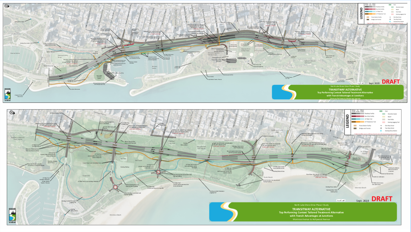
Overview of the drive from Diversey to Hollywood.
View high-res renderings of the proposal here.
The plans for revamping the Uptown section of North Lake Shore Drive calls for some transit enhancements, but some local residents at last week's community meeting on the project felt that they are still too car-centric.
As Streetsblog has documented extensively over the years, the Chicago Department of Transportation and the Illinois Department of Transportation are currently working on a study to improve the north portion of Lake Shore Drive. Many segments need either major rehabilitation or complete reconstruction. And the two transportation agencies want to use that as an opportunity to reconfigure the drive and the surrounding streets to better fit current transportation needs.
CDOT revealed the latest version of the plans during the September 26 hearing -- the last of the three community meetings on the plans that have been held held at Larry McKeon Student Services Building at Truman College at local Alderman James Cappleman’s request. The meetings are part of the greater outreach CDOT and IDOT are doing as they prepare to redo the entirety of North Lake Shore Drive. The three uptown meetings focused on the area around the portion of highway between Lawrence and Montrose Avenue.
During the latest hearing, the transportation officials presented three possible alternatives. The plan the agencies prefer called for putting bus turnarounds on the east side of Lake Shore Drive, closer to the beach; adding some bus-only lanes on LSD access ramps; and installing underpasses or overpasses in locations where the Lakefront Trail crosses east-west streets. For drivers, the biggest change would be the removal of access ramps at Wilson, adding stoplights at offramp and street intersections, and adding some more parking lots east of Lake Shore Drive, which would encourage more people to bring cars to Montrose Beach.
According to the maps provided at Thursday's meeting, the preferred alternative includes bus-only queue jump lanes at the access ramps at Belmont, Addison and Foster avenues, as well as Irving Park Road.
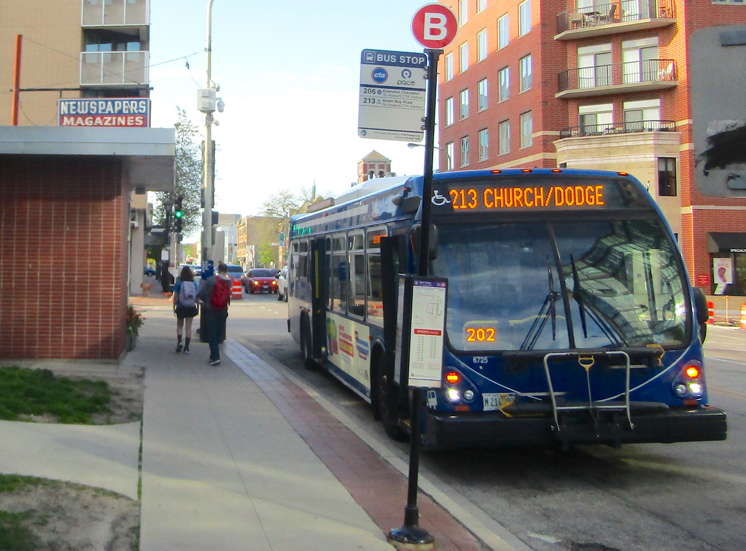
Right now all the east-west bus routes (with the exception of the #78 Montrose bus, which serves Montrose Beach during the summer) turn around west of the highway, which means that anyone who wants to visit lakeside beaches and parks has to walk or bike the rest of the way. The plan calls for adding bus turnarounds east of the highway, near existing parking lots, for the #77 Belmont, #80/Irving Park, #78 Montrose (which also serves a portion of Wilson Avenue), and #81 Lawrence routes. It also calls for setting up a bus staging area for the #152 Addison line east of the highway.
The Lakefront Trail currently crosses all of the major east-west streets at grade level near the access ramps, with the trail, street, and ramp intersections regulated by stop signs. The plan would grade-separate the trail intersections, with an overpass at Foster Avenue and underpasses at the other junctions, while the off-ramps would get new stoplights. Officials said that is expected to significantly reduce delays. This prompted one of the attendees to ask why CDOT couldn’t put in traffic lights tomorrow - earning applause.
Nathan Roseberry, CDOTs acting assistant chief highway engineer, replied that the strategy would be to implement minor improvements first. The only obstacle, he said, is that officials don’t want to put in any new infrastructure only to have to tear it out later when the drive is rebuilt, so they want to make sure the plans are finalized before making changes.
Several residents asked about how the project would be funded, with one resident asking if tax increment financing could be used for that. Cappleman responded that while infrastructure is a valid use of TIF money, one issue is that CDOT can’t spend money from a particular TIF district for a project outside of that zone.
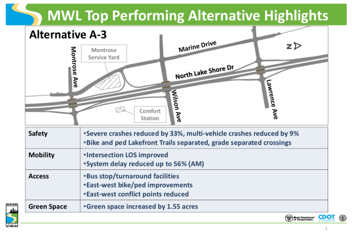
Some residents raised concerns about eliminating the Wilson ramps, noting that the largest parking lot in Montrose Harbor is located east of them. Roseberry responded that, according to their models, grade-separating the trail crossings would save drivers enough time that taking other nearby ramps wouldn’t add too much travel time.
With the first phase of the study completed, Roseberry said that the next phase will include land acquisition and more detailed planning, while the final phase will include construction. While the exact timeline is contingent on funding availability, Roseberry told me that CDOT hopes to complete Phase II by 2021 and start construction around 2025.
Marianne Lalonde, who ran against Cappleman in the last election, told me that her one takeaway from the meeting was that “it’s disappointing that we’ll lose so much green space in the rear of Clarendon Park.”
During the Q & A, resident Melanie Eckner expressed skepticism about how much the plan serves pedestrians and cyclists. In a follow-up interview, she later told me that, given how many residents use “green modes of transportation,” the plan should reflect their needs.
“This plan puts pedestrians underground [in underpasses], underneath cars, in our historical Lincoln Park,” Eckner said. “It’s [a plan] where cars go first and hikes and pedestrians are kind of tacked on top.This neighborhood is demonstrating all those great sustainable modes, and this all about cars."
She's got a good point. If it's so important to facilitate driving on the east-west streets that cross the trail, why don't we make make motorists use tunnels or overpasses, instead of people walking and biking?
Stay in touch
Sign up for our free newsletter
More from Streetsblog Chicago
Elevated Chicago’s new leader on how to build more support for equitable transit-oriented development
Recently announced as executive director Juan Sebastian Arias also shared his POV on Mayor Johnson's Cut the Tape initiative to speed up the development approval process


Since COVID, Pace ridership has fared better on major corridors and in north, northwest suburbs than in south, west ‘burbs
The suburban bus system's top five busiest routes largely maintained their ridership rankings.

Due to incredible support from readers like you, we’ve surpassed our 2023-24 fundraising goal
Once again, the generosity of walk/bike/transit boosters is fueling our reporting and advocacy.