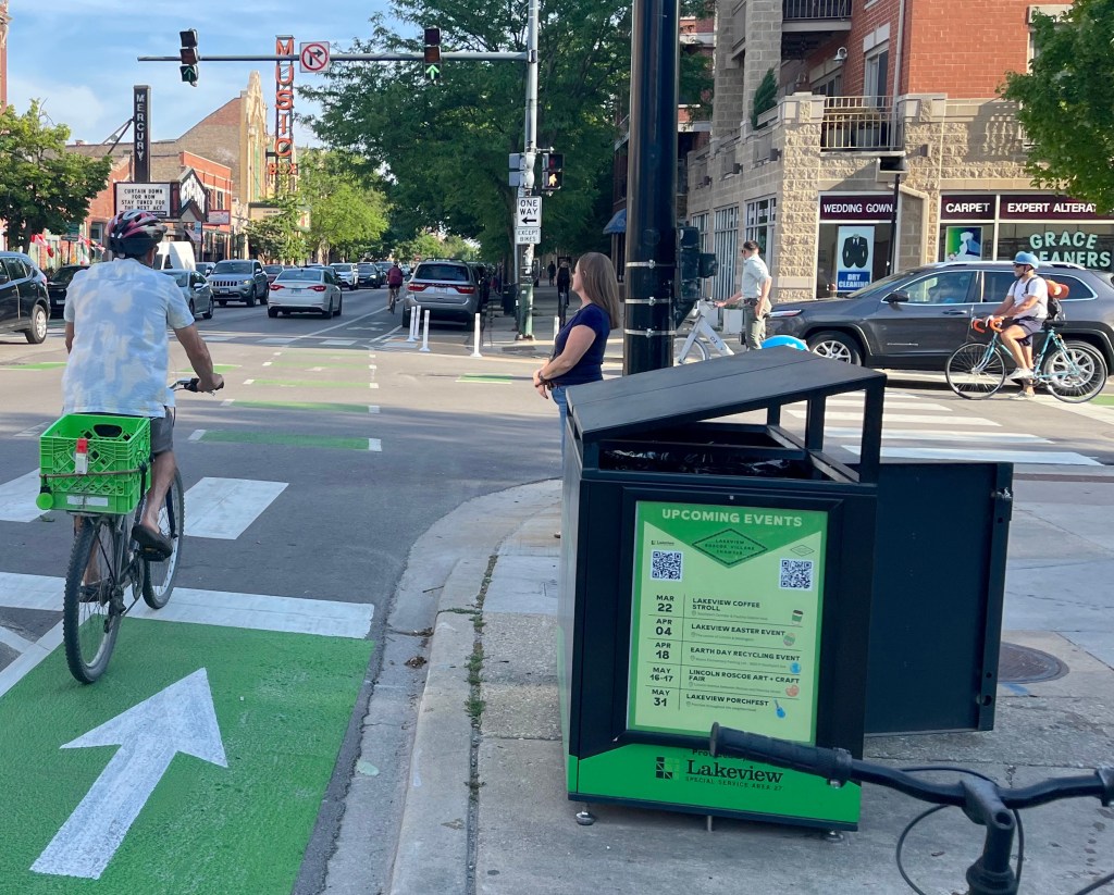
Eyes on the Street: Milwaukee Bottleneck Update and New Bikeways
The Chicago Department of Transportation is chugging along, creating new buffered and protected bike lanes this summer. Recently, new stretches of buffered lanes were striped striped in Noble Square, on Noble between Erie and Augusta, and downtown, on Upper Randolph between Michigan and the bike station.
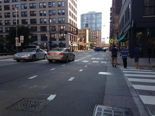
Before I went to check out a couple of new stretches of buffered lanes this morning, I stopped by the construction bottleneck on Milwaukee north of North. I was pleasantly surprised to see that paper “No Parking” signs are still affixed to poles on the east side of the block, and drivers seem to be respecting them. As a result, there’s sufficient road width for north- and southbound cyclists to share the road with motorists fairly safely.
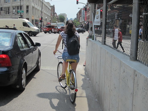
Last week, Streetsbog reader Andrew Scalise sent us a photo of a tow truck enforcing the parking ban, which is a likely factor in the compliance by drivers. There are also some safety cones sitting in the gutter.
Next, I dropped by Noble, which now has buttery-smooth new asphalt. Noble has always been a good biking street, but the addition of the good pavement and buffered lanes should make it an even more popular route. The lanes have dead space striped on the right side to encourage cyclists to ride out of the door zone.
Noble connects Milwaukee, the city’s busiest biking street, and Erie, a good east-west connection between Ukrainian Village and River West. The new lanes would be even more useful if CDOT striped a contraflow lane on the short, one-way northbound block of Noble between Augusta and Milwaukee.
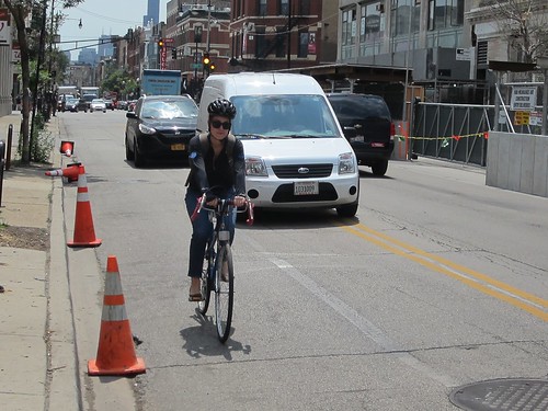
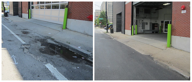
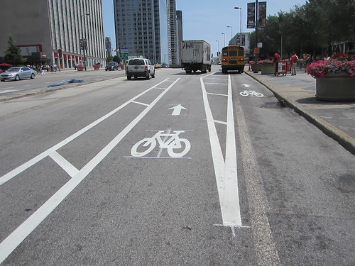
After that, I cruised southeast to check in on the new protected bike lanes on Harrison from Deplaines to Wabash. Flexible posts still need to be installed, and people are still parking in the lanes in stretches where “No Parking” signs haven’t been added yet, but I noticed a couple of new improvements. Terrible pavement in the bike lane across the street from the Greyhound station has been replaced. Of course, that segment need to be restriped now.
Last week, Streetsblog’s Steven Vance told me he wasn’t pleased with the design of the lanes at Dearborn. At the time, the westbound bike lane seemed to disappear before the intersection to make room for a wide right-turn lane for motor vehicles.
However, CDOT has since added a wide green stripe and a sharrow to make it obvious that it’s a shared lane. While it’s still possible for bike riders to get stuck behind right-turning motorists yielding to pedestrians, at least it’s obvious where you’re supposed to pedal.
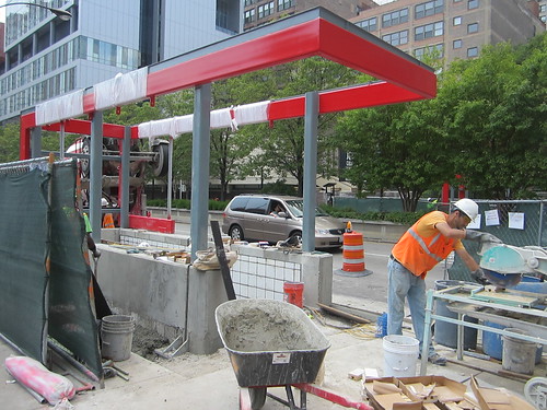
At State, I got to check out construction on one of two new entrance canopies for the Harrison Red Line stop. The $10 million, TIF-funded station rehab project will also waterproof the mezzanine and platform areas, repair three staircases, and add new new granite floors and LED lighting.
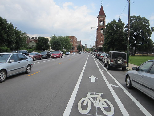
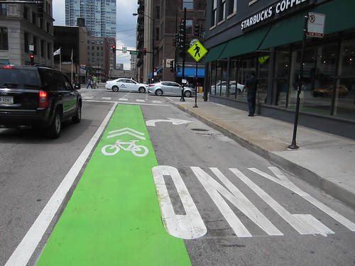
Last, I stopped by Upper Randolph, where the existing conventional lanes have been upgraded to buffered lanes with dead space striped on both sides. Where the eastbound lane is curbside near Michigan, next to Millennium Park, it still chiefly functions as a standing zone for tour buses. However, further east, the lane moves to the left of a parking lane, and the buses only partially block the bikeway.
CDOT also added another short stretch of buffered lane to shepherd cyclists to Lower Randolph, where they can ride a few more blocks east to access the Lakefront Trail. Hopefully, the department is planning to add a stretch of green paint here to alert motorists to look out for cyclists merging left.

Read More:
Streetsblog has migrated to a new comment system. New commenters can register directly in the comments section of any article. Returning commenters: your previous comments and display name have been preserved, but you'll need to reclaim your account by clicking "Forgot your password?" on the sign-in form, entering your email, and following the verification link to set a new password — this is required because passwords could not be carried over during the migration. For questions, contact tips@streetsblog.org.