Skip to content
Sponsored

Today's stories are presented by

SBC Bike Lane Fest 2025-26: Mid North Side, including Irving Park, Avondale, North Center, Logan Square, and Lincoln Park

SBC Bike Lane Fest 2025-26: Mid North Side, including Irving Park, Avondale, North Center, Logan Square, and Lincoln Park
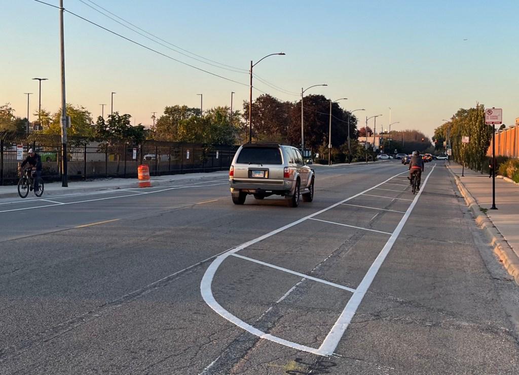
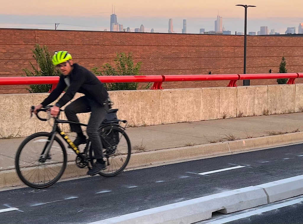
The Chicago Department of Transportation has partially completed the curb protection upgrade of the bike lanes on the Damen Avenue bridge over the North Branch of the Chicago River. Each bike lane is marked with a dashed center line to facilitate passing other users. All photos in this post are by John Greenfield.
This post is sponsored by the Active Transportation Alliance.

Greetings Streetsblog Chicago followers. Once again, we had wonderful weather in the Windy City today, so this afternoon I took a few more new bikeways off my to-do-list as part of SBC Bike Lane Fest 2025-26. This time I visited facilities Irving Park, Avondale, North Center, Logan Square, and Lincoln Park on the Mid North Side.

If you’ve been following this series, you already know the drill, so please skip the explanation in italics that follows, which is simply cut-and-pasted from yesterday’s post about the Far Northwest Side.

This website’s Map of 2025-26 CDOT Bikeway Installations, shown below, is based on the Chicago Department of Transportation’s Bikeways Installations Tracker spreadsheet. That document has not been refreshed since July 17, 2026, but I’m generally trying to stop by the sites of projects that are listed as “Upcoming Construction” or “In Construction,” as well as ones that have been “Installed,” to check on their current status.

In addition, you can take a look at CDOT Existing Bike Network Map, to get a sense of how the new facilities fit into the network. However, that map shows all bikeways that have been installed in modern history, while SBC’s map just shows the newer ones.

Today I checked out everything that I haven’t already inspected within the district bounded by Montrose Avenue, Kedzie Avenue, the Kennedy Expressway, Fullerton Avenue, and the Lakefront. Major projects within this zone that I previously covered include the Grace Street Neighborhood Greenway, and the Wellington Avenue Greenway.
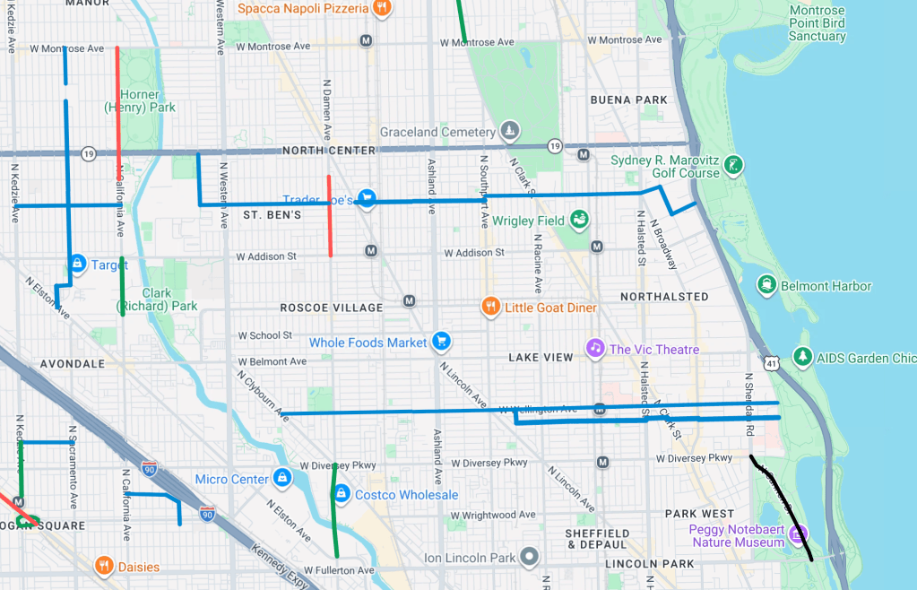
Today’s travel zone. Image: Google Maps

All right, let’s get this show on the road, so to speak. Descriptions are in the captions.

California Avenue in Irving Park
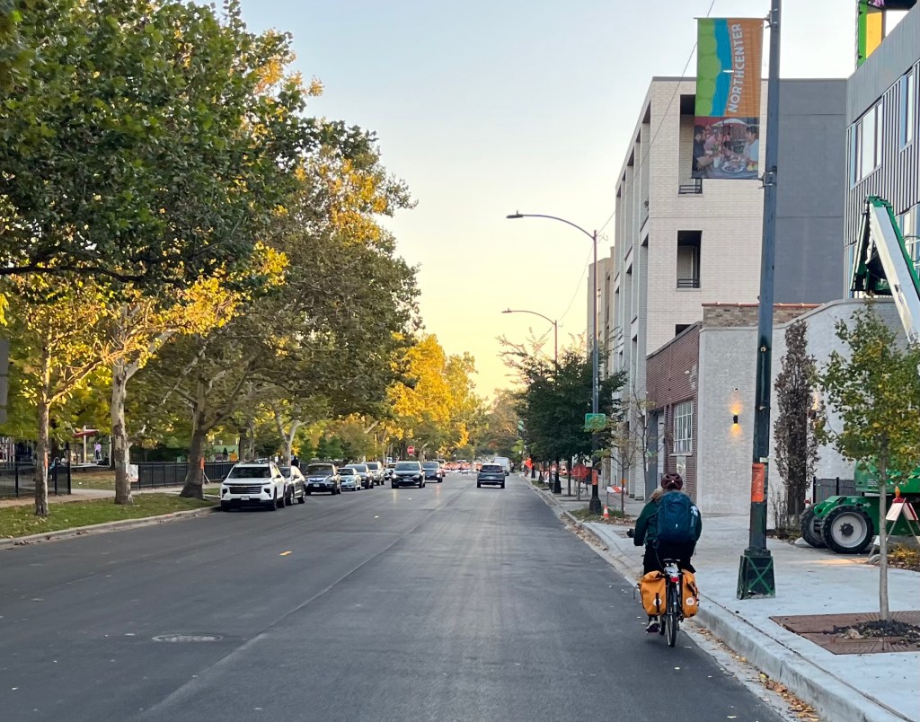
The stretch between Montrose Avenue and Byron Street is slated for non-protected bike lanes, and it was recently repaved, but the bikeway hasn’t been marked yet. (While the banner in this photo, taken near Montrose/California looking south, says “North Center,” according to the City’s official community area boundaries, this is actually in the Irving Park community.)

Sacramento Avenue in Irving Park and Avondale
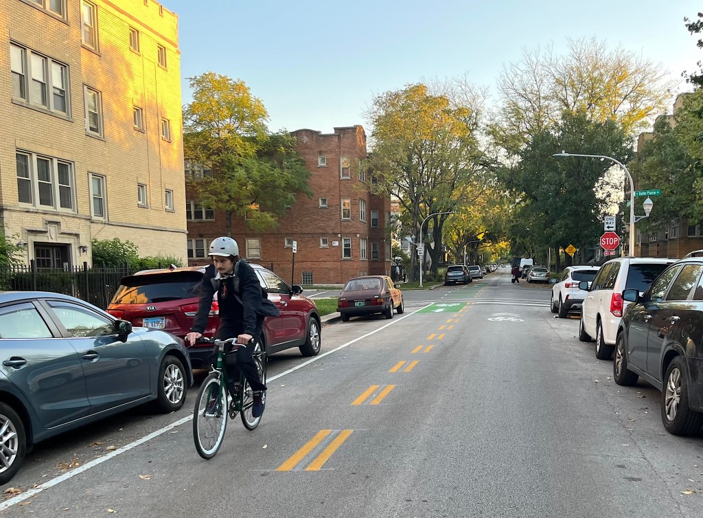
This Neighborhood Greenway includes a northbound contraflow bike lane between Montrose and Irving Park Road, to allow two-way cycling a segment that is one-way for drivers, shown here at Belle Plaine Avenue.
At its south end, the Sacramento Greenway jogs west on Cornelia Avenue (shown here, looking south), and then heads south on Whipple Street to connect with Elston Avenue, which has non-protected bike lanes.

California Avenue in Avondale

The stretch between Addison Street and Belmont Avenue is supposed to get protected bike lanes, but so far those have only started materializing north of Roscoe Avenue. Presumably some kind of physical protection, preferably concrete curbs or islands, as opposed to flexible plastic posts, will be added here soon.

Damen Avenue in North Center

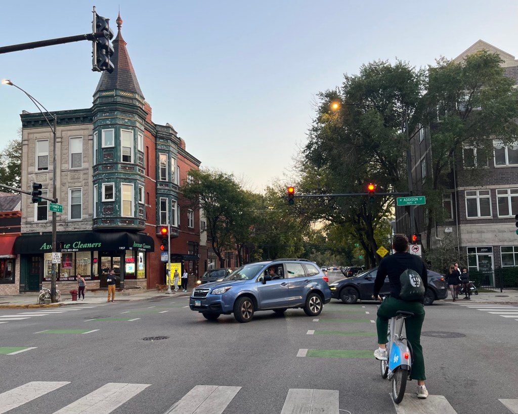
Dashed “Advisory Bike Lanes” have been painted on Damen between Byron Street and Addison. This photo was taken at Addison/Damen, looking south. At the base of the light pole on the left, there is a “ghost bike” memorial for health coach Anastasia Kondrasheva, 23. It was installed after a turning trucker fatally struck the young woman at that corner in September 2016. The tragedy helped bring about the passage of an ordinance requiring side guards and safety mirrors for trucks used in City contracts.

Damen Avenue in Lincoln Park and Logan Square
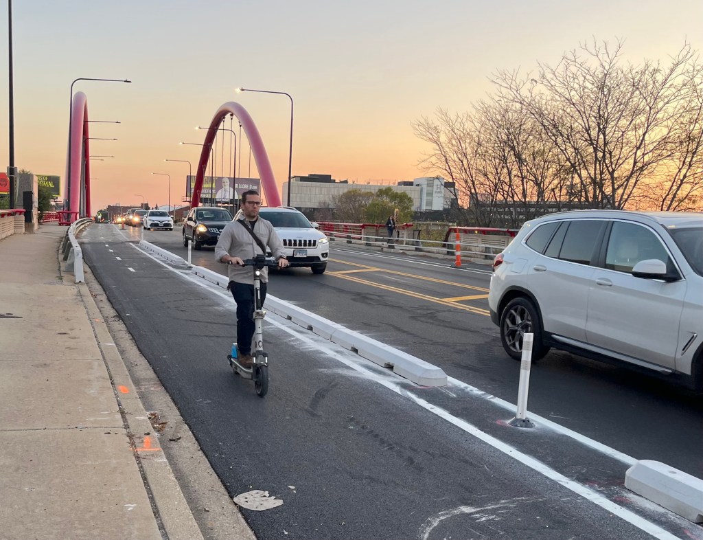
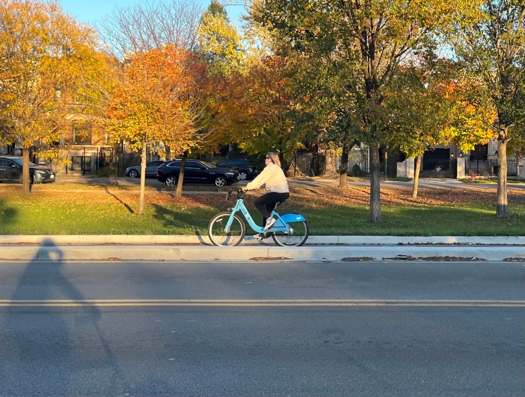
Curb protection has been partially installed on the bike lanes near the river bridge between Diversey Boulevard and Fullerton Avenue.

Cannon Drive in Lincoln Park

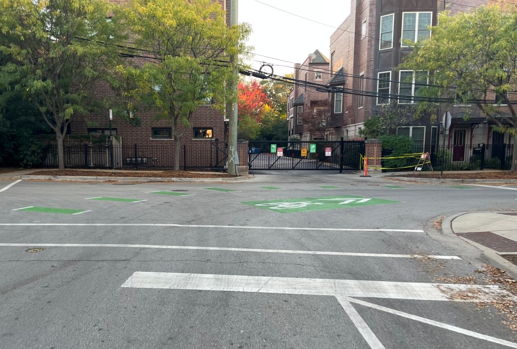
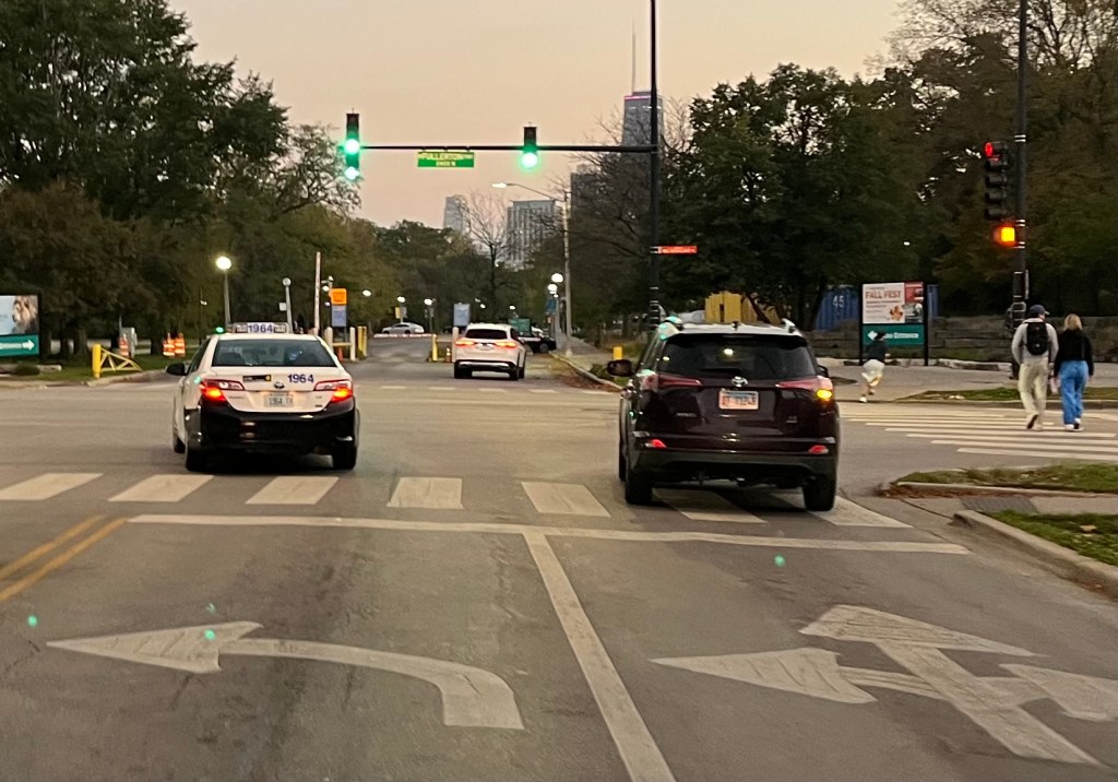
The stretch between Diversey and Fullerton is supposed to get “marked shared lanes,” aka “sharrows,” but it doesn’t look like anything has been marked yet. This photo was shot at Fullerton.

Here are some previous Bike Lane Fest 2025-26 posts:

• “It’s time for Streetsblog Chicago’s Bike Lane Fest 2025-26“

• “Is the Wellington Greenway a victory for cyclists, and a Waterloo for bikeway foes with a Napoleon Complex?“

• “Take a virtual walk on the Winnslie Parkway Expansion, and ride on the Ravenswood Avenue Greenway“

• “SBC Bike Lane Fest 2025-26: Far South Side, including Roseland, Pullman, South Chicago, South Shore, and Greater Grand Crossing“

• “SBC Bike Lane Fest 2025-26: Far North Side, including Lincoln Square, West Ridge, Rogers Park, Edgewater, and Uptown“

• “SBC Bike Lane Fest 2025-26: Far Northwest Side, including Albany Park, Forest Glen, and North Park”

If you appreciate Streetsblog Chicago’s reporting and advocacy on local sustainable transportation issues, please consider making a tax-deductible donation here. Thank you!

Photo of John Greenfield
In addition to editing Streetsblog Chicago, John has written about transportation and more for many other local and national publications. A Chicagoan since 1989, he enjoys exploring the city and region on foot, bike, bus, and train.

Read More: