Under-Zoning Is Exacerbating Displacement Near The 606
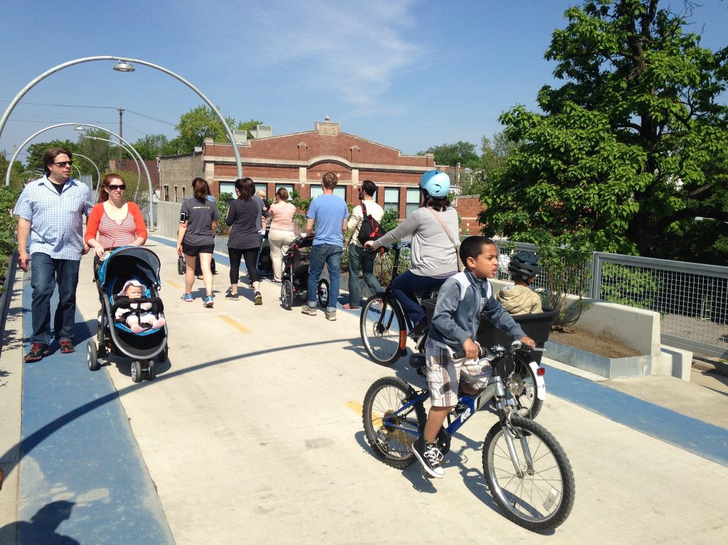
The Bloomingdale Trail, aka The 606, which opened in June 2015, is a terrific recreation and transportation amenity that serves four neighborhoods – Bucktown, Wicker Park, Logan Square, and Humboldt Park – on Chicago’s Northwest Side. While the blocks around elevated greenway had already been gentrifying before work on the trail began in August 2013, a November 2016 a report from DePaul’s Institute for Housing Studies found that property values along the western stretch of trail had gone up by 48.2 percent since the groundbreaking. Moreover, most of the vacant lots along the western half are being used to build single-family homes, which means that the population of the area will probably never return to its higher historic levels, when there was more multi-unit housing.
The area is “under-zoned,” meaning that the current zoning doesn’t allow the construction of new multi-family housing to be built, and discourages the preservation of existing housing that’s affordable. Fifty percent of the area within two blocks of the entire Bloomingdale Trail allows only single-family houses to be built “as-of-right,” without requesting a zoning change from the local alderman. Only 29 percent of the area is zoned to allow new buildings with more than one dwelling unit to be built as-of-right. The remaining 21 percent of the area includes “planned developments” (which involve additional city and community oversight, and usually have multi-family housing in them), plus parkland and industrial space.
The Institute for Housing Studies has published a new map showing displacement pressure in Chicago, i.e. the current level of vulnerability that households have to being priced out of the neighborhood, based on the income levels of current residents, property values and changes in sale prices. The areas shown in red on the map”have a high share of lower-income renters, families, and seniors who are vulnerable to displacement when costs increase.”
Let me tell you a little bit about the Census tract I live in, 2301, just south of Julia de Burgos Park, a 606 access park located on the north side of the trail between Whipple and Albany. I live a block away from the park and I love having convenient access to the greenway. As you can see from the map detail shown here, IHS’s study says that tract 2301 is a high cost area and there are significantly rising housing prices.
According to the Census, 483 people moved out of my tract between 2000 and 2016. But the “zoning capacity” of the area wouldn’t allow the same number of people to return to the tract because it doesn’t allow for enough new housing units to be built to accommodate them all. The same thing is generally true for the adjacent tracts.
The role of zoning
The zoning designation RS-3, which allows only one single-family house per property, is the most common “zoning district” in my Census tract, covering 73.8 percent of the area. Multi-family housing can be built as-of-right on 25.4 percent of the area. But the current designation doesn’t reflect the kind of housing that already exists there. Many existing two-, three-, and four-flats in the area are “legal, non-conforming” uses on land zoned for single-family houses.
Zoning also dictates how existing buildings can be modified. For example, if a single-family house is in a district that allows multi-family housing, the homeowner could renovate the basement into a rentable dwelling unit. In addition, the property owner of a multi-family building could add or split units.
(Interestingly, one thing that’s not allowed, regardless of the zoning district, is the construction of new coach houses. These structures, also known as accessory dwelling units, are common in Chicago, but you can’t build new ones, and if you make major renovations to an existing one you can no longer rent it out.)
During the same period that the population of my tract dropped by 483, the number of occupied housing units decreased by 4.4 percent due to demolitions and the replacement of multi-unit housing with single-family homes.
Vacant lots are being used almost exclusively for single-family housing
In the 2015 property tax year, the Cook County assessor classified 17 properties in my tract as vacant land. Three of them are zoned to allow between two and four units depending on the lot size, and one is zoned to allow up to four units. The remaining lots are all zoned for single-family housing only. One of these vacant lots is double-wide, but since it’s zoned for single-family, only one house may be built on this large piece of land without a zoning change.
If the maximum number of allowed units were built on all 17 lots, my tract would add 29 housing units. The current density of the tract is 2.7 people per unit. If the households that move into these 29 units maintained this density, 78 people would occupy these units.
New policies proposed or adopted
In May three Near Northwest Side alders introduced an ordinance called the Pilot Act for the Preservation of Affordable Housing in the 606 Residential Area, which would charge an additional fee of between $300,000 and $650,000 for deconversions of multi-family buildings into single-family homes, as well as a fee for enlarging existing buildings, along the western half of The 606. This revenue would be used to fund affordable housing in the area. Nine months later, the ordinance is still languishing in City Council
In October, Mayor Rahm Emanuel introduced and the Council passed two other ordinances with the stated goal of increasing the amount of affordable housing in gentrifying areas on the West and Near Northwest sides. One of the new laws, which went into effect on November 1, requires that developers of projects with 10 or more units set aside 15 percent of the units as affordable, instead of the usual 10 percent, and eliminates the option of instead paying a fee that goes to the city’s affordable housing fund. However, that ordinance will have no effect on the amount of affordable housing in my tract because the zoning doesn’t allow buildings this large.
Since 2015, most of the vacant lots in my tract have been developed, have active construction projects, or were recently issued building permits. Two of the lots that allow multi-unit buildings have received permits for multi-family housing. The other two aren’t currently being developed. All of the single-family zoned lots are getting single-family houses. In addition, in some cases single- and multi-family buildings have been demolished to make room for new single-family houses, further reducing the number of available housing units.

Read More:
Streetsblog has migrated to a new comment system. New commenters can register directly in the comments section of any article. Returning commenters: your previous comments and display name have been preserved, but you'll need to reclaim your account by clicking "Forgot your password?" on the sign-in form, entering your email, and following the verification link to set a new password — this is required because passwords could not be carried over during the migration. For questions, contact tips@streetsblog.org.