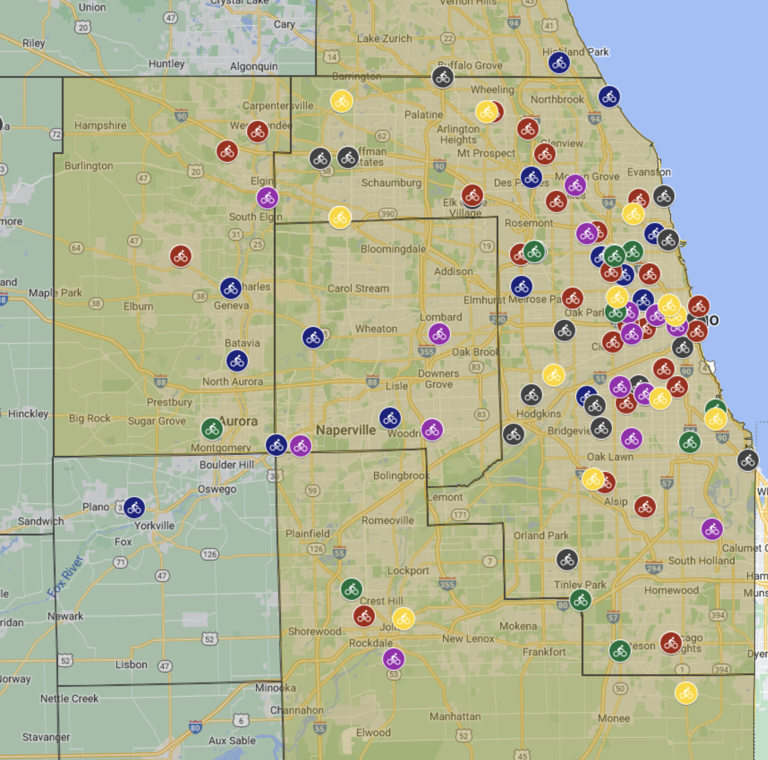
Recent Streetsblog CHICAGO posts about map

Mapping How BRT Will Improve Access Along Ashland

| | 94 Comments
In a recent blog post, Metropolitan Planning Council associate Yonah Freemark presented an ingenious visual that makes it obvious how BRT will dramatically improve transit access along the corridor. Using data from Mapnificent, which shows the area you can reach with transit from any point in a given time, Freemark created a map that illustrates […]

Which Chicago Neighborhoods Are the Most Bikeable?

| | 15 Comments
Earlier this week, the people at Walk Score updated its rankings of America’s most bikeable cities, and Chicago came in at number 10. In addition, they released a city-by-city list of the most bikeable neighborhoods. You can see Chicago’s top bikeable neighborhoods as rated by Walk Score in the map above. (Eight “neighborhoods” listed in […]

P-Street on Milwaukee Could Help Empty Lots Develop Into Walkable Places

| | 7 Comments
Alderman Proco “Joe” Moreno of the 1st Ward has introduced an ordinance that would zone Milwaukee Avenue between Sacramento Avenue and Rockwell Street/Francis Place as a Pedestrian Street, or P-Street, which could help ensure that future development is walkable and pedestrian-friendly. The P-Street concept was codified in 2004 as an attempt “to preserve and enhance the […]