Details on 7 livable streets projects that won funding in the 1st Ward PB election
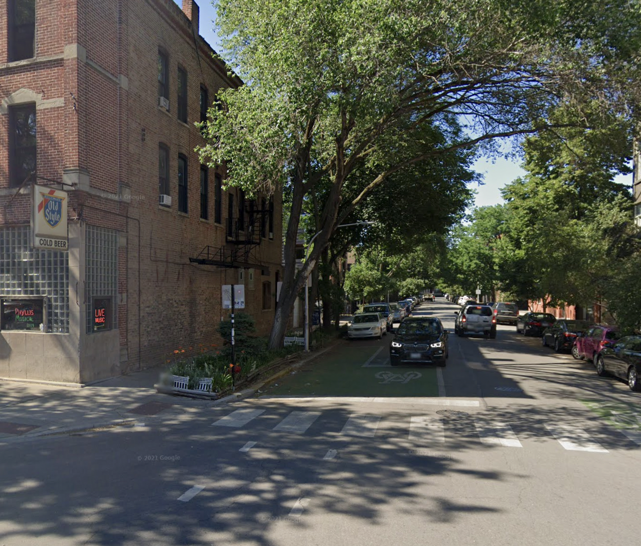
Green bike box pavement markings at Division and Wood, part of the Wood Street Neighborhood Greenway. 1st Ward residents voted to convert the corridor to a one-way northbound street to make room for a two-way protected bike lane. Image: Google Maps
There's some good news from the Near Northwest Side. As originally reported by Block Club Chicago, 1st Ward residents recently elected to fund seven of the 11 projects proposed by neighbors in the district's participatory budgeting election, and all of the winning proposals will improve local walking, biking, and/or transit.
In Chicago PB elections, which have become more common in recent years, constituents get to make suggestions on how some or all of the ward's discretionary "menu" infrastructure funds are spent. In the 1st Ward, Alderman Daniel LaSpata, who has been an outspoken supporter of traffic safety and active transportation upgrades, agreed to earmark about one million out of the district's $1.5 million in menu money for PB projects, with the remainder set aside for cost overruns and street and alley repaving. The ward includes parts of the West Town and Logan Square community areas.
Streetsblog Chicago co-editor Courtney Cobbs comments, "Chicago needs a well-funded city transportation budget so that wards don't have to use discretionary funds on projects like these."
But let's take a closer look at the projects that won 1st Ward menu funding, in order of the number of votes they received.
Add bus/bike lanes on Chicago Avenue between Ashland and Western in West Town.
Estimated cost: $100K. 92 votes.
Description: "Improve user experience on Chicago Ave. by adding a shared bus/bike lane from Ashland to Western. 'Bus Only' lane markings were added along this stretch, but have faded. This proposal would repaint the lanes and add [bike symbols] as well."
My thoughts: In fall 2020, the city painted 4.6 miles of bus-only lanes on Chicago between Ashland and Laramie avenues. While these were cheap, quick pop-up bus lanes — hence no red paint — drivers appeared to be reasonably respectful of them. If they've faded, the Chicago Department of Transportation should really take care of repainting them, and preferably upgrading them with red paint, on the entire corridor, not just the easternmost mile. But adding bike symbols is probably a good idea. In general it doesn't seem to be a problem for confident bike riders to cycle in Chicago bus lanes, and adding bike symbols will make it clear this is legal. However, Chicago Avenue is an important retail corridor, so it really needs safe access for bike riders of all confidence levels. Therefore, stripping one of the car parking lanes to make room for physically-protected bike lanes and bus lanes would be a better solution.
Install sidewalk bump-outs and a new crosswalk at Division and Paulina streets in West Town
Estimated cost: $150K, 82 votes
Description: "Pedestrian infrastructure will be improved on Division St. between Ashland Ave. and Wood St. This stretch has many businesses and other points of interest for pedestrians, and safer crossing points would help all road users. Specifically, this proposal would improve pedestrian safety at the intersection of Division and Paulina by adding curb extensions at SE and NE corners and painting a new pedestrian crosswalk."
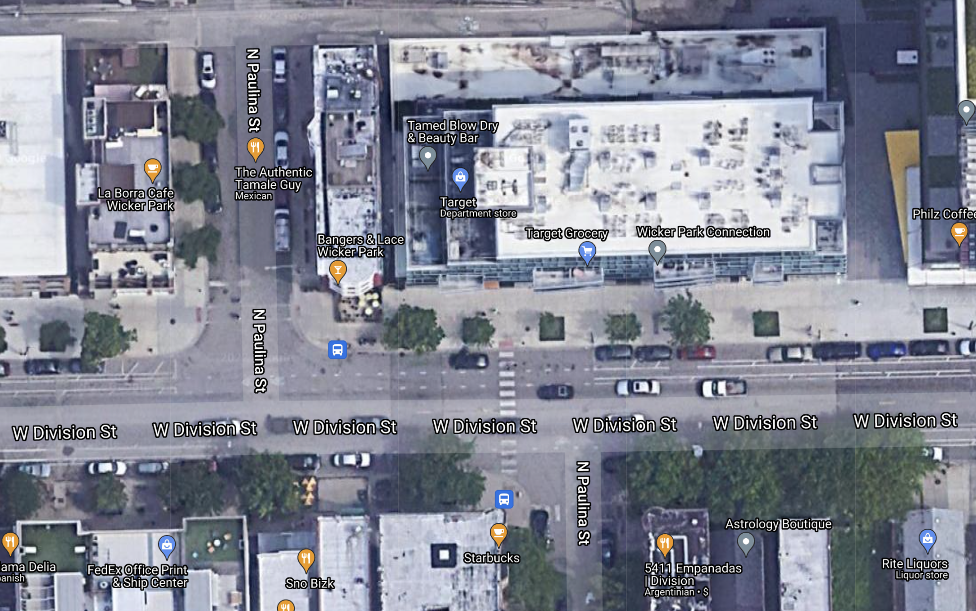
My thoughts: Since Paulina jogs at Division, the bustling business strip on the border of Wicker Park and Ukrainian Village, there are actually two T-shaped Division/Paulina intersections. Additional info on the proposal specifies that the person who suggested it is talking about the easternmost of the two, where there's a faded crosswalk in the west leg of the junction connecting a Target store with a Starbucks. This is probably a fairly busy crossing so, sure, adding bump-outs to shorten the pedestrian crossing distance and restriping the crosswalk is a good idea, especially since there are no stop signs for east-west traffic on Division. Of course, it would be great to add new crosswalks and sidewalk extensions to other legs of the two intersections that lack them.
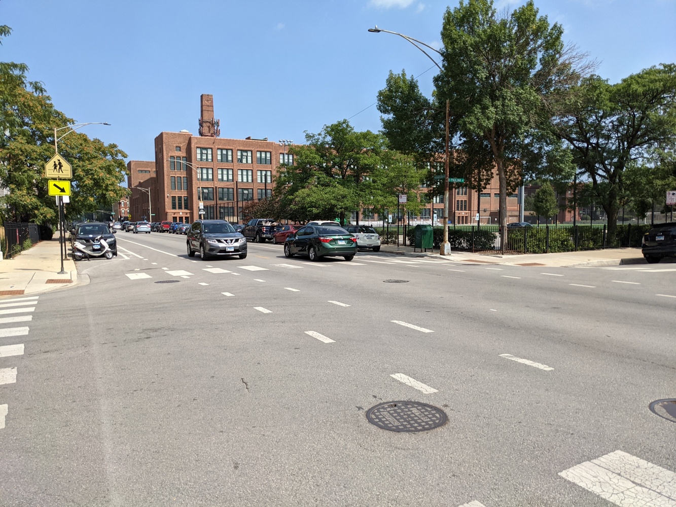
Build curb extensions on August Boulevard at Paulina and Wood streets
Estimated cost: $150K. 81 votes.
Description: "Pedestrian infrastructure will be improved on Augusta Blvd. between Ashland Ave and Honore. This stretch is a busy car and bike corridor and safer crossing points would help all road users. Specifically, this proposal would improve pedestrian safety by adding curb extensions at Paulina St. and Wood St."
My thoughts: The Augusta/Paulina intersection is at the northwest corner of Wells Community Academy, and the intersection has no stoplights or stop signs for east-west traffic on Augusta, so bump-outs might be useful for students walking to school. The need for sidewalk extensions at Augusta/Wood is less obvious since there's a stoplight at that intersection. Commenters said that in general there are problems with drivers not stopping for pedestrians on Augusta, and many families with young kids cross on this stretch, so they'd like to see more crosswalks and stop signs for east-west traffic.
Add sidewalk bump-outs to intersections on Armitage Avenue between Milwaukee Avenue and Humboldt Boulevard
Estimated cost: $200K. 80 votes.
Description: "Pedestrian infrastructure will be improved on Armitage Ave. between Milwaukee Ave. and Humboldt Blvd. This stretch has many businesses and other points of interest for pedestrians and safer crossing points would help all road users. Specifically, this proposal would improve pedestrian safety at several intersections along this stretch by adding curb extensions for pedestrians. Potential intersections are Milwaukee Ave., Bingham St., Point St., and Francisco Ave."
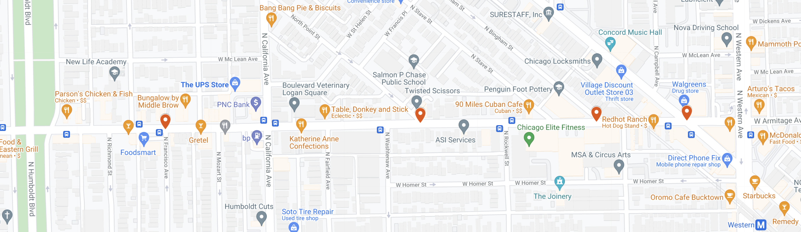
My thoughts: Sure, sidewalk bump-outs would be helpful on this busy stretch of Armitage, especially at intersections like Bingham, Point, and Francisco that don't have stoplights or stop signs for east-west traffic. This person also proposed extending the existing Armitage bike lanes west of Milwaukee. Dashed bike lanes are already slated for this stretch of Armitage.
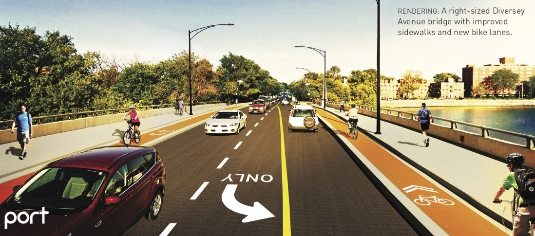
Install protected bike lanes on the Diversey Avenue bridge over the Chicago River
Estimated cost: $100K. 79 votes.
Description: "Bike infrastructure will be improved on Diversey between Logan Blvd. and Damen Ave. This will improve bike network connectivity by linking the new Logan Blvd. [protected] bike lanes to Damen Ave. with protected bike lanes in both directions. Diversey would be decreased from two travel lanes in each direction to one between Leavitt and Logan."
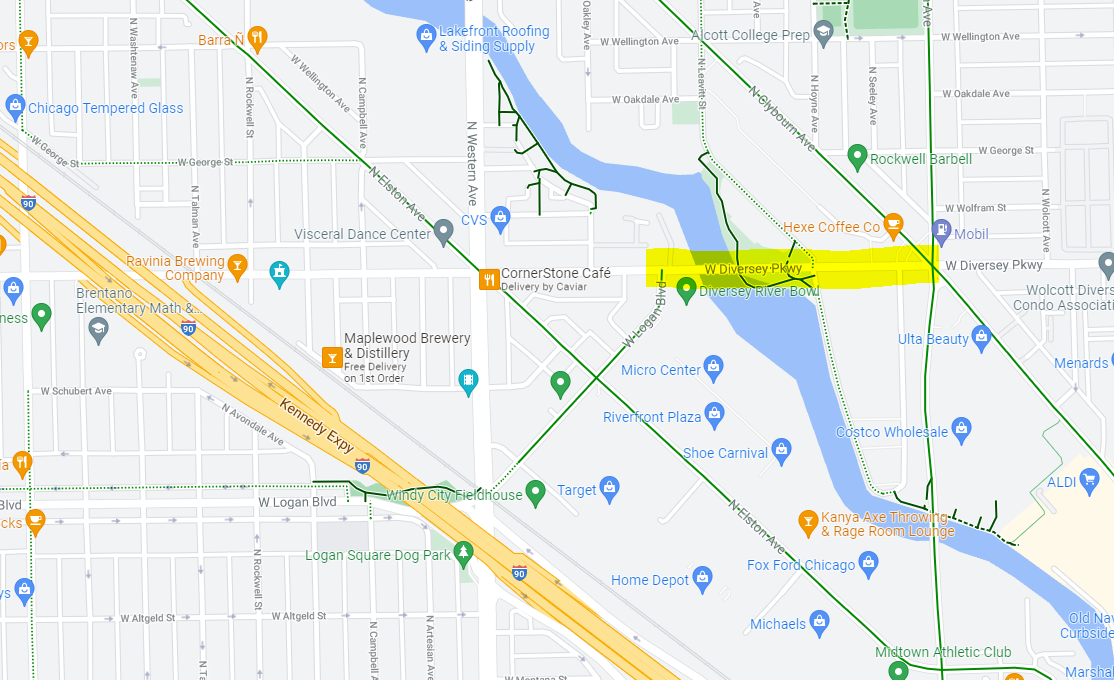
My thoughts: This is the project on the list I'm most excited about. It's something people who bike have been asking for for years, and as such it's a no-brainer, although there could be some pushback to the road diet from drivers. Back in 2018, The Active Transportation Alliance partnered with the Logan Square Neighborhood Association and Port Urbanism to propose safety improvements for the Diversey/Logan corridor, and curb-protected bike lanes were one of the key recommendations. The road diet will help calm traffic. However, it will be important to have concrete curbs or some other sturdy barrier between bike riders and traffic, not just the usual flexible plastic posts.
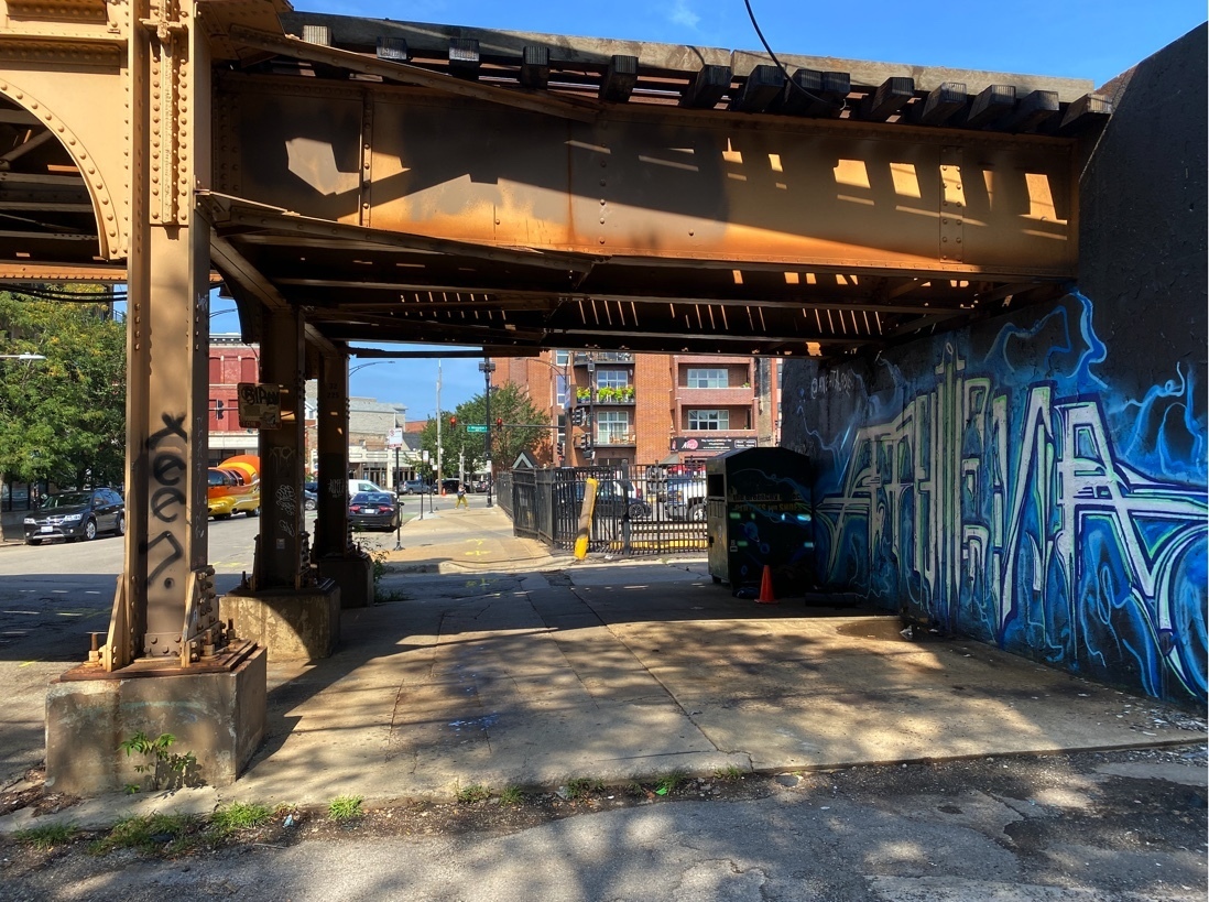
Add lighting, clean up under the Blue Line tracks at Wolcott and Milwaukee avenues
Estimated cost $100K (although Block Club reported this might be able to be done at no cost to the ward.) 73 votes.
Description: "The underpass beneath the Blue Line at 1378 N Wolcott Ave. (near Milwaukee Ave. and Walgreens) is always in really rough shape. There's always trash, empty beer/liquor bottles, and clothing scattered around this underpass. Even worse, there is no underpass lighting here – absolutely nothing and it is pitch dark at night It would be a huge enhancement if LED lighting (even a few lights!) was added at this spot. Even a simple wired garbage container at this spot would probably help the situation as well."
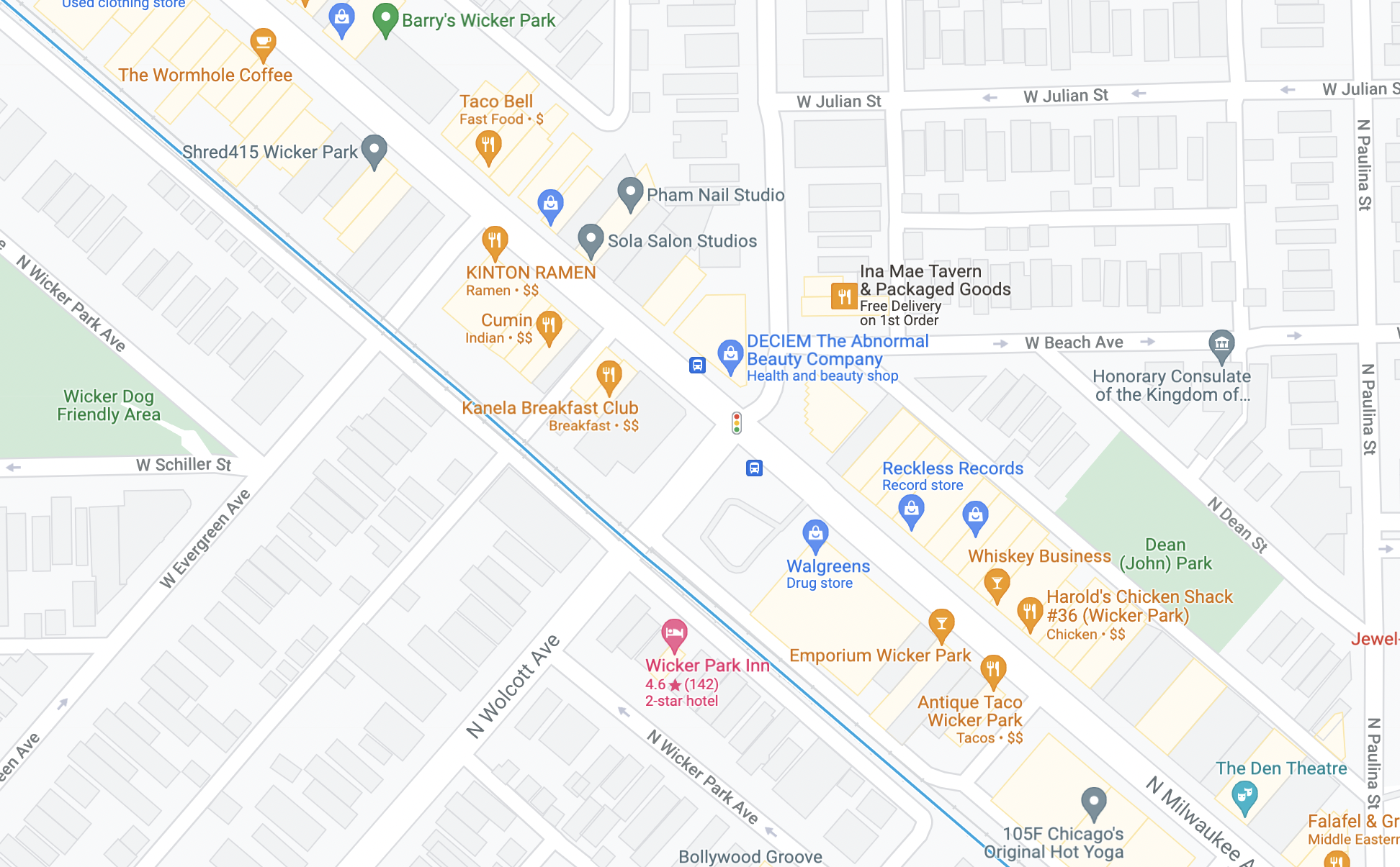
My thoughts: This doesn't strike me as a particularly urgent issue, since we're talking about people quickly passing under the 'L' tracks, not a long dark viaduct. And I lived just around the corner from here back in the late Nineties, when the area was significantly less gentrified, so I think I know what I'm talking about.
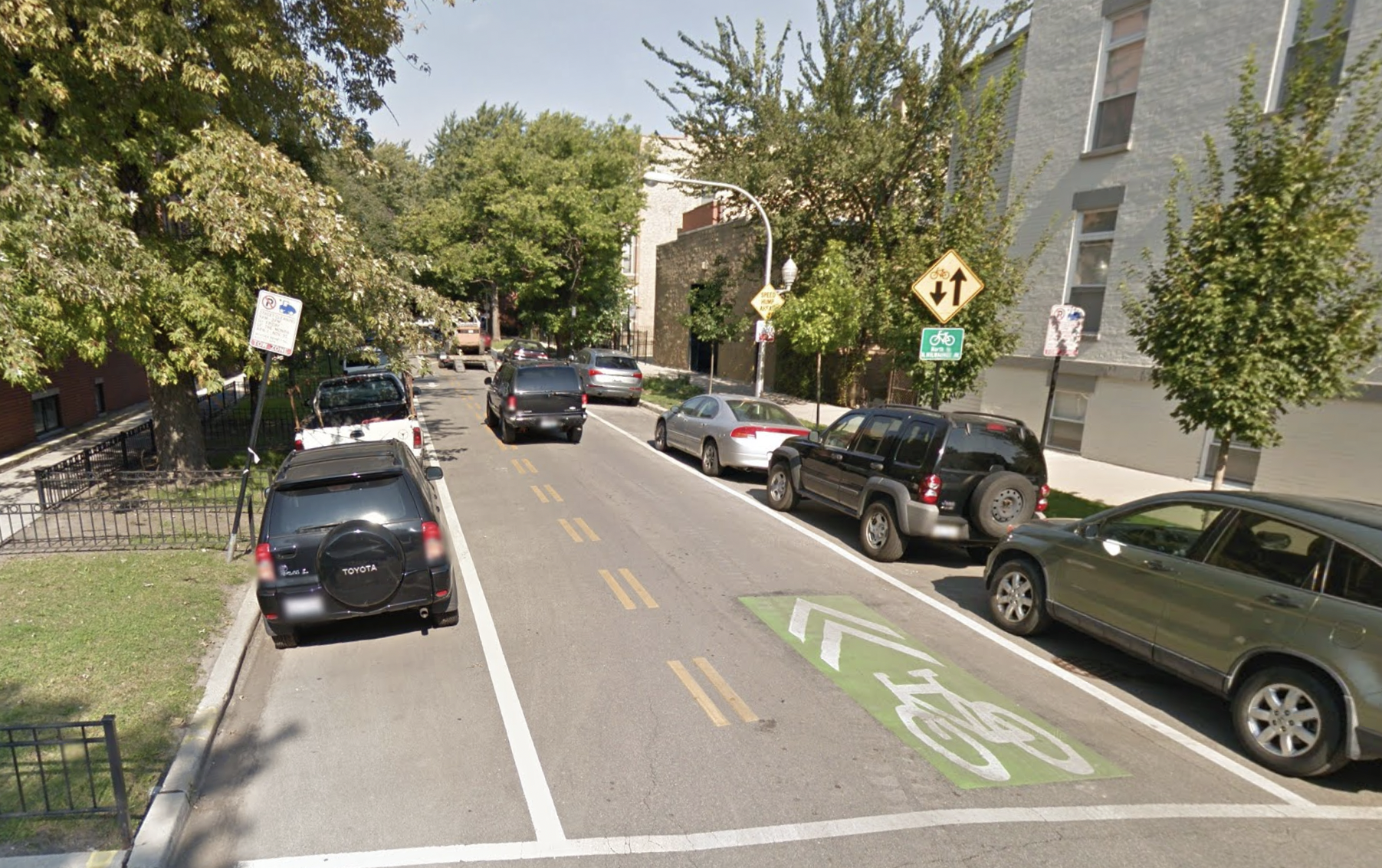
Converting Wood Street from Grand Avenue to Ellen Street to one-way, and adding a two-way protected bike lane
Estimated cost: $325K. 67 votes.
Description: "Wood St is a designated bike route in Chicago's bike plan. This proposal would upgrade bike infrastructure from Chicago Ave. to Ellen St. by adding protected two-way bike lanes for a full mile on this street. Wood would be changed from two-way to one-way (northbound) to accommodate these bike lanes and preserve residential parking."
My thoughts: To be perfectly frank, when I first heard about this proposal, it didn't sound like a great use of resources to me. Even when it had no bikeway at all, this portion of Wood was a nice place to bike, with relatively little car traffic, and stoplights or four-way stop signs at every intersection. And back in 2014 the Chicago Department of Transportation installed a Neighborhood Greenway treatment on this stretch, including a contraflow ("wrong-way") bike lane at the north end of the corridor to allow for two-way riding on a one-way block; bike-and-chevron markings; and bike boxes to give cyclists a place to wait in front of stopped cars at stoplights. (That was almost eight years ago? Time flies!)
In general, installing protected bike lanes on side streets seems unnecessary to me. My thinking is that, since Wood is already a pretty chill place to ride, this infrastructure would be better applied to a main street, where there's a more urgent need to separated bike riders from fast motor vehicle traffic.
However, when Streetsblog Chicago tweeted about the project back in November, many of our readers disagreed with me. Here are some of the responses:
- "Chicago needs as many high quality hard-protected bike lanes as it can get – it's life-threateningly scary to bike most Chicago streets today."
- "Yes please!"
- "Sounds great!"
- "Great! Do it yesterday!"
- "Yes! More low stress bike lanes and routes!"
- "I take Paulina south every day to go to work so this would make my commute infinitely safer."
Whereas the only negative response I saw was from someone who thinks Wood has an annoyingly large amount of stop signs. So, I dunno, if lots of Streetsblog readers are jazzed about this project, maybe I'm wrong about it?
Other projects that weren't elected
- Add lighting, murals, and other aesthetic improvements to Logan/Western viaduct.
- Repave Cortland from Kimball to Central Park, and Wolcott from Milwaukee to Potomac.
- Create a low-stress two-way bike route on Ohio from Damen to Ogden.
- Add a sidewalk and curbs to the north side of the 1300 block of West Moorman.
Stay in touch
Sign up for our free newsletter
More from Streetsblog Chicago
Tasty news: Friedman Properties is trying to break the Clark outdoor dining stalemate by applying for street closure permits
Mayor Johnson's administration and Ald. Reilly haven't yet found common ground on bringing back the popular car-free zone. Will this make the difference?
Today’s Headlines for Thursday, April 18


Roger that! Streetsblog SF editor Roger Rudick offers constructive criticism of Chicago’s downtown bike network
"There were blocks that felt very safe and very secure," he said. "But then you're immediately – voom! – disgorged into three lanes of moving traffic with no protection."
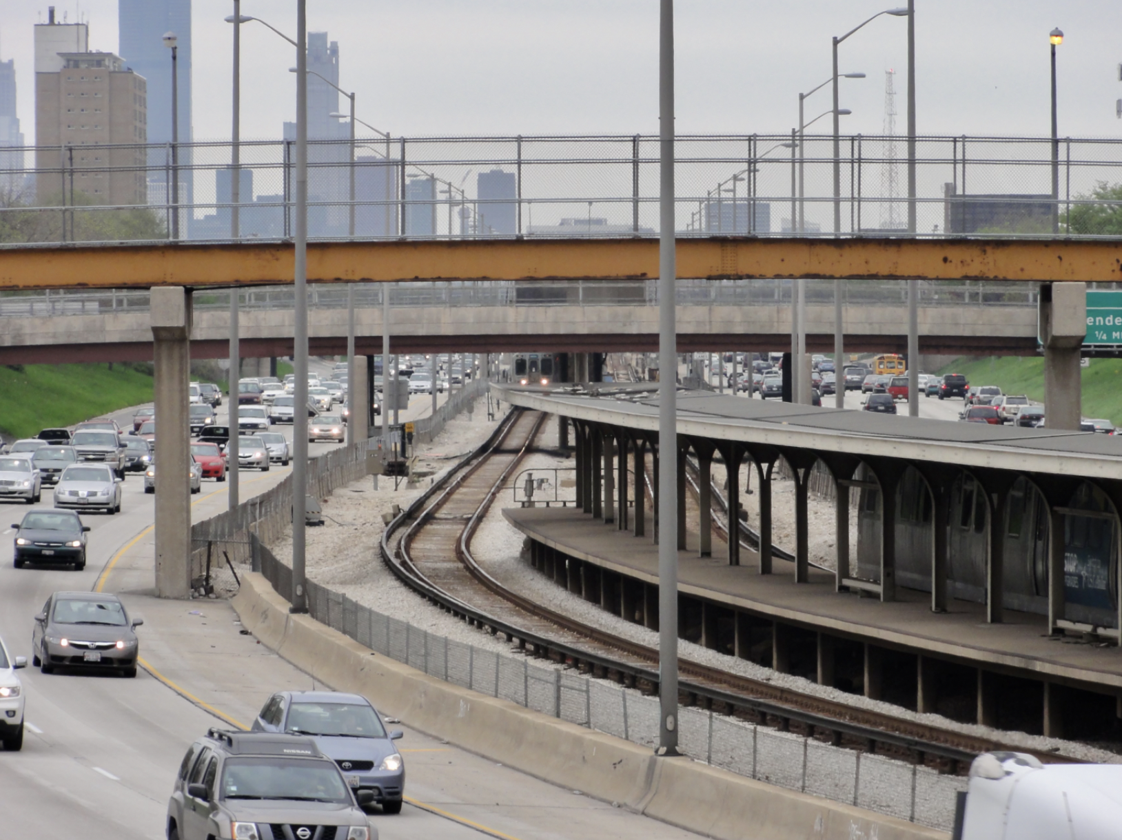
City announces $2M federal grant to address harms caused by I-290 by improving walk/bike/transit access
The Mayor's Office says the money will fund "improvements for people walking and bicycling on existing streets and paths surrounding and crossing the corridor."